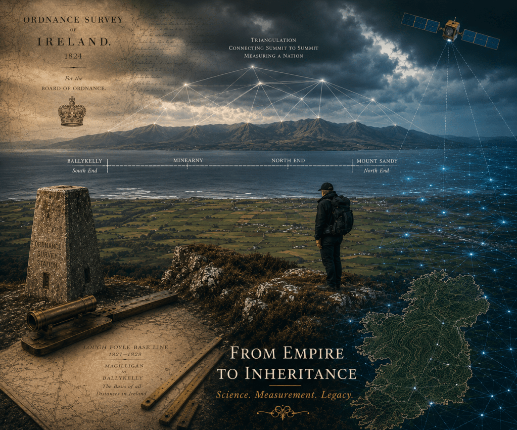
The Ordnance Survey in Ireland began as a British government mapping project. Through science, measurement and the work of remarkable individuals, it transformed how Ireland was mapped, understood and remembered, leaving an important legacy.
The Survey of Ireland arose not from antiquarian curiosity or scientific idealism, but from the needs of the nineteenth-century British state. Started in 1824, it was both a military and administrative undertaking, providing the geographical knowledge considered necessary to defend and tax the country. The government in London determined its purpose, the British Treasury funded it, the Board of Ordnance organised it, and Royal Engineers and Sappers carried it out. In every practical sense, it was an imperial project.
At the same time, it sought to understand the country through scientific measurement. Its architects believed that accurate geographical knowledge would support better taxation and also improve administration, infrastructure and public works, reflecting the wider nineteenth-century confidence that scientific enquiry could serve the public good. What followed, however, was far more than its founders intended, and the enterprise became part of Ireland’s own inheritance.
Maps as Instruments of Power
To acknowledge the Survey’s imperial origins is to recognise the uncomfortable reality that maps cannot be treated as entirely neutral. Every map reflects choices about what is recorded, what is omitted, how places are named, in what language and which boundaries are recognised. These are choices made by someone.
By mapping a country, a state gains the ability to define it on its own terms, reinforcing its authority over both the landscape and the people who inhabit it. In that sense, maps are instruments of power as well as tools of knowledge. In Ireland, this has often shaped how the Ordnance Survey is remembered.
For some, these developments represented administrative efficiency and scientific progress. The same maps that extended administrative authority also enabled engineering, valuation, scientific research and public administration on a scale that had previously been impossible. Some critics, on the other hand, saw the Survey as an unwelcome imposition of colonial authority onto everyday life. It is a tension that Brian Friel captured effectively in his play Translations. Although not a history of the Survey, the play captures how measurement can change the way that a landscape is understood. [i]
An Enduring Technical Legacy
If empire supplied the purpose, science supplied the authority. The foundation of the entire enterprise was precise measurement. From the carefully measured baseline on the shores of Lough Foyle, a network of triangles spread across the island, linking mountain summit to mountain summit, and Ireland to Great Britain. Every distance on the map depended on that first line. Colby’s compensation bars achieved a level of precision that astonished contemporary scientists, while Thomas Drummond’s limelight made long-distance triangulation possible on a scale previously thought unattainable. Together, these innovations transformed the practical science of surveying and established standards against which future surveys would be judged.
The authority of the map did not rest on the power of the state alone, but also on the credibility of its methods. Accuracy became both its principle and its justification. As Colby repeatedly insisted, “Accuracy once lost cannot be recovered.” That commitment reflected the nineteenth century’s confidence that careful measurement and scientific enquiry could reveal the complexity of the world. The Ordnance Survey brought those Enlightenment ideals to Ireland on an unprecedented scale through triangulation, levelling and contours.
During the nineteenth century, the Royal Engineers, under the Board of Ordnance, expanded surveying from disconnected local schemes into a coherent national system capable of measuring an entire country with extraordinary precision. Successive revisions would keep the maps current while continually improving them as instrumentation, methods and knowledge advanced. More than a remarkable series of accurate maps, the Survey demonstrated that geography could be measured systematically and continually refined.
It also created a common geographical language. For the first time, Ireland could be described consistently through shared place names, boundaries, symbols and scales, while successive editions established a common cartographic vocabulary. In this way, the map became more than a representation of the landscape. It provided a spatial reference through which government, engineers, valuers, geologists, scholars and society itself could describe, analyse and manage the country within a consistent geographical framework.
In this way, the Survey established principles that continue to underpin modern cartography and geospatial science. Extending the precision of the Lough Foyle baseline and its longitude from Greenwich through triangulation created a single national reference framework in which every point could be related to every other. Although positions are now determined by satellites rather than mountain-top observations, the underlying principle remains unchanged.
The Survey also transformed maps from artistic illustrations into instruments of measurement. Position, distance and height became quantities that could be observed, calculated and verified. Contours represented the form of the land objectively, laying the foundations for modern terrain modelling and environmental analysis.
Equally important was the recognition that a national map could never remain complete—as the landscape changed, the map had to change with it. Systematic revision established the principle that geographical information requires continual maintenance, anticipating today’s concepts of data currency and continuously updated geospatial databases.
Nearly two centuries later, those intellectual foundations remain remarkably familiar. The principles of scientific measurement, precision, standardisation and revision established by the nineteenth-century Ordnance Survey continue to underpin modern mapping and geographic information systems.
Individuals Made it Possible
The history of the Irish Survey is also the story of the individuals who imagined it, built it and carried its influence far beyond the map itself. Thomas Colby provided vision and leadership; Thomas Drummond, scientific ingenuity; Thomas Aiskew Larcom, organisational discipline; John O’Donovan, scholarly authority; and Richard Griffith, expertise that extended into geology, valuation and public administration.
Their achievements depended equally upon hundreds of largely anonymous Irish and British sappers, chainmen, labourers and draughtsmen whose names rarely entered the historical record. Men such as Alexander Smith on Slieve Snaght or Gunner Phibbs on Cuilcagh briefly emerge, then disappear again.
The Survey became a meeting place for scientists, engineers, scholars, and public servants, who together transformed how Ireland was measured, governed, described and remembered. They left a legacy that is still written into the landscape they surveyed.
Measurement Met Memory
As the surveyors arrived with their instruments, notebooks and maps, they found another, older geography, embedded in language, folklore, genealogy, local tradition and collective memory. The story of MacSweeney of Doe symbolises the encounter between measurement and memory. Whether regarded as history, folklore or something in-between, it reflects a wider transition taking place in nineteenth-century Ireland. Older ways of understanding place rested upon ancestry, memory and local knowledge. Increasingly, they coexisted with an administrative system founded upon measurement, documentation and official record. The Survey sought certainty where tradition preserved ambiguity, and for government, valuation, engineering and administration, the published map increasingly became the authoritative geographical reference. It shifted where geographical authority resided.
Some historians and writers have interpreted this encounter as a story of dispossession, loss and cultural change. Yet displacement alone does not fully explain what followed. O’Donovan and his colleagues depended upon schoolmasters, clergy, farmers and storytellers to explain names and traditions that scientific measurement alone could never reveal. In recording them, the Survey preserved a remarkable body of cultural knowledge that might otherwise have disappeared. The irony is striking: an exercise aimed at strengthening administrative authority became one of the most important institutional records of nineteenth-century Irish language, tradition and local knowledge.
It is tempting to romanticise the world that existed before the Survey, but that risks replacing one simplification with another. The map could never replace local memory, just as memory alone could not map the landscape. The legacy of the Ordnance Survey lies not in the triumph of one over the other, but in the continuing and productive dialogue between measurement and memory.
Empire Produced an Irish Inheritance
The officers, sappers, chainmen, labourers, scholars and draughtsmen who carried out the Survey of Ireland have long since disappeared. Yet the work of these Ghosts of Mountjoy remains visible almost everywhere in townland boundaries, placenames, benchmarks, triangulation stations and the geographical foundation that still underpins modern Ireland. Conceived and directed in pursuit of imperial objectives, the Survey would soon pass beyond the state that created it to become part of Ireland’s own inheritance.
That inheritance extends far beyond maps. O’Donovan’s placename research recorded and preserved a substantial body of language, tradition and local knowledge, while the measurements made by Colby and his surveyors were the precursor for later generations’ valuation, engineering, national mapping, satellite positioning and modern geographic information systems.
Perhaps this is the Survey’s deepest legacy. What began as a means to measure and administer a country, transformed the relationship between Ireland, its people and geographical knowledge itself. Measurement became the meeting place between science and memory, producing a modern understanding of Ireland that drew upon both. The Survey reflected the priorities of the time and of the state that created it, and its scientific methods, cultural consequences and institutional legacy became part of Ireland’s own story.
For that reason, the history of the Ordnance Survey resists simple judgement. To regard it only as an instrument of colonial power is incomplete; to celebrate only its scientific achievement is equally inadequate. It was both. Chains may have given way to satellites, the limelight to lasers, and engraved sheets to digital maps, yet that scientific and cultural framework still shapes how Ireland, and the world, is measured, mapped and understood.
Born as an imperial project of the British state, the Ordnance Survey became part of Ireland’s own inheritance.
Footnotes
[i] Friel, Brian, John Andrews, and Kevin Barry. “Translations and a Paper Landscape: Between Fiction and History.” The Crane Bag 7, no. 2 (1983): 118–24. http://www.jstor.org/stable/30060606.
By subscribing, you will be notified of new posts.
