The surveyors moved through a landscape haunted by the remnants of an older Gaelic order. They sought to standardise Ireland’s boundaries and names, and found a country where authority rested between memory and record, ancestry and administration.
Mac Sweeney of Doe
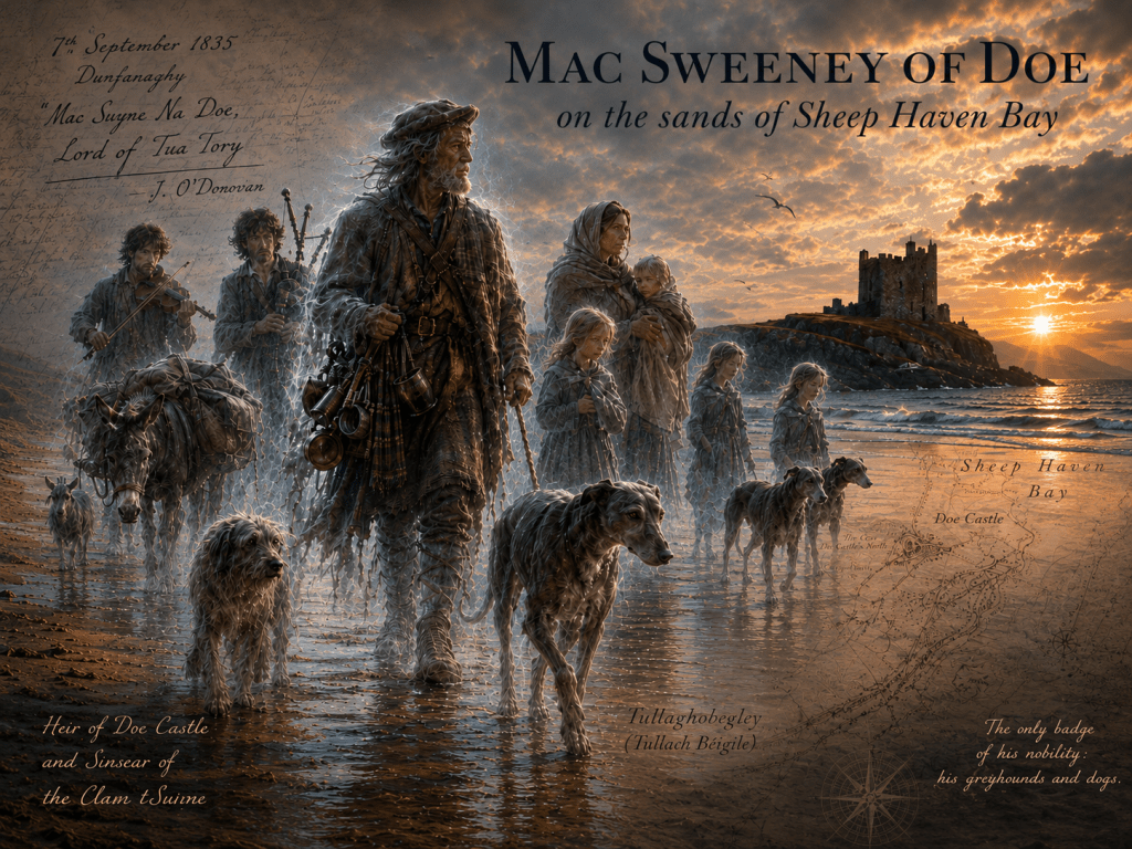
In September 1835, John O’Donovan encountered the remnants of an older Ireland. He was collecting names for the Ordnance map of Donegal when, in the distance, he saw a group of people walking along the sands of the shore of Sheep Haven. [1]
The blue waters of Sheep Haven contrast with the yellow sand and the emerald green of the shoreline. A tall man, three women and some children walked along the fine, smooth yellow strand. They were accompanied by a donkey loaded down with packs, straps and bags, and followed by some greyhounds, other dogs, and a goat. Their dishevelled attire seemed to be at odds with their stately, upright grace.
“What group is this on the strand?” O’Donovan asked a local fisherman.
“That,” said he, “is Mac Swyne (Mac Sweeny) Na Doe and his family, the heir of Doe Castle and the Sinsear (head) of the Clann tSuivne, who though he retains all the high notions of his forebearers, has been obliged to exchange the sword and battle-axe for the budget and the soldering iron, and the spirited, richly caparisoned steed for the tame and rudely hampered ass. The only badge of his nobility are now his greyhounds and dogs, of which no petty game hunters have dared to deprive him”.
Doe Castle stands on the shores of Sheep Haven Bay, where the water narrows and turns inland. It is on a small spit of land, almost an island, held between tide and shore. It is not a grand castle; there are no wide approaches or sweeping avenues. Instead, it rises abruptly from the edge of the water: a compact, almost modest tower house enclosed by a bawn wall. Its stones are grey and weathered, its form shaped for defence rather than display. The sea presses close on one side; on the other, the land offers only a narrow access. It is a place chosen not for comfort, but for security. From here, the coastal lands between Gweedore and Rossguil, the ancient administrative territories, or tuath, were controlled under the pre-Elizabethan Gaelic order. In these earlier times, Mac Sweeney of Doe was a “warrior by profession (renowned above heroes, a fire-brand glowing and inextinguishable)”.
Curious about them, O’Donovan arranged to meet the family at the fisherman’s cottage. On entering the house he was astonished at the sight of the sons, two able-bodied young men, with “thighs as thick as those of two fat bullocks”, playing the pipes and fiddle with deafening sound.
The father arrived at the door of the fisherman’s cabin, dressed in his professional attire, a tinker with the manner of a lord, carrying the implements of his profession. He looked at O’Donovan with good humour and ease associated with travelling gentlemen and with a countenance which spoke his descent from “a goodly race”.
O’Donovan, out of respect for the past, greeted him as ‘Mac Swyne Na Doe, Lord of Tua Tory’; and Mac Sweeney, taking O’Donovan’s hand, returned the salutation as the representative of his race. O’Donovan handed him a glass of whiskey.
Mac Sweeney sat down and told O’Donovan his story. He spoke of his family, naming each generation carefully in sequence, carrying the line back to Sir Maolmhuire Mac Suibhne. The names came down through the ages as an unbroken chain. Land had been lost, authority eroded, but the family memory and standing remained clear. He described the decline in the family’s status without complaint as something that had happened, step by step, until this was what remained. There remained a belief, half hope, half inheritance, that what had been taken might one day be restored. That the lands of Doe, the headland beyond, might yet return to the name he carried.
Despite his attire and current profession, Mac Sweeney’s heritage was treated with respect by both fishermen and the figures of the new authority that now ruled the land. His sons were employed by Captain Hart, a local man of means in the Doe / Dunfanaghy area. Hart represented a different kind of local authority: one based on land, employment, and position rather than lineage. He held Mac Sweeney in high regard, listening to his stories of the old Gaelic chiefs, treating their descendant with courtesy, even respect. Mac Sweeney accepted this without irony or pity for his own plight.
This was not simply a story of dispossession. On the strand at Sheep Haven, O’Donovan encountered the lingering presence of an older order still carried through memory, genealogy, and place. Earlier maps of Ireland had been closely bound up with conquest and confiscation, reflecting the imposition of a new colonial order. William Petty’s Down Survey recorded confiscated lands and their reassignment with administrative efficiency. Yet the collapse of the Gaelic order was never complete or orderly. Older systems persisted in places, while elsewhere they were adapted, overlain, or absorbed into newer structures of administration and taxation.
The Ordnance Survey formed part of this longer process, contributing to the standardisation of land information across Ireland. What the Survey sought to fix on paper had long been carried in memory, genealogy, local speech, and inherited knowledge of place. Yet at its heart lay a paradox. The new maps imposed administrative coherence upon Ireland, but in recording names, traditions, boundaries, and local testimony, the Survey also preserved fragments of an older world that might otherwise have disappeared. [2]
The surveyors, whom I would later remember as the “Ghosts of Mountjoy”, moved through a landscape already haunted by the remnants of an older Gaelic order. They sought to standardise Ireland’s land, its boundaries and names, and in doing so, they encountered and recorded competing forms of authority: written and oral, administrative and ancestral.
Mac Sweeney’s story makes that tension visible in a single life. O’Donovan captured both the story and the problem: how to fix on a map a landscape still alive in memory.
This story continues next week: 27. Names on the Map: Authority, Language and the Ordnance Survey.
Footnotes
[1] He wrote regularly to Thomas Larcom at Mountjoy Barracks, describing his work, the people, the place names and the history of the areas he encountered. The story of the encounter between O’Donovan and Mac Sweeney of Doe is recounted in O’Donovan’s letter to Larcom of 7th September 1835, written from Dunfanaghy, published in Ordnance Survey Letters Donegal. Ed. Michael Herity, Four Masters Press, Dublin, 2000.
[2] For example, in the Ordnance Survey Memoirs: See post 15. Life Along The Line
Header image is AI generated.
By subscribing, you will be notified of new posts.

Responses
[…] John O’Donovan met Mac Sweeney of Doe on the sands of Sheep Haven Bay, he was not merely recording a local story. The encounter revealed […]
LikeLike
[…] embedded in language, folklore, genealogy, local tradition and collective memory. The story of MacSweeney of Doe symbolises the encounter between measurement and memory. Whether regarded as history, […]
LikeLike