Authority, Language and the Ordnance Survey
The six-inch survey’s standardisation of Irish place-names into English was not just a technical matter. It was an exercise in authority over memory, language, and history.
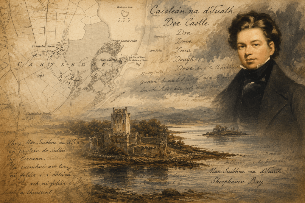
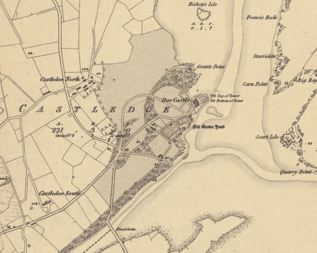
When John O’Donovan met Mac Sweeney of Doe on the sands of Sheep Haven Bay, he was not merely recording a local story. The encounter revealed a central tension in the Survey’s work in Ireland: features on the map demanded a single official English name, while the people and the landscape preserved competing claims of language, pronunciation, memory, and history.
By the nineteenth century, many Irish place-names existed in several forms at once. Local speech, written records, estate papers, and official usage often diverged sharply. Centuries of Norse, Norman, Scottish, and English influence had altered names derived from Irish, while older forms survived unevenly in speech and tradition. One observer has described the result as an “impenetrable fog of unintelligibility.” [1]
Mapping the country required more than transcription. It required a decision about which form would appear on the map, and that decision would help determine which versions of the past were preserved in official use.
In Britain, the early Ordnance Survey generally relied on local usage, moderated by official records and by clergy, landowners, and local officials. Even this relatively informal system encountered difficulties in Wales, where English and Welsh usage produced competing forms of the same name. [2]
In Ireland, place-names carried layers of language, historical record, and local recollection that could not easily be reconciled within a single spelling. The military surveyors were instructed not merely to note current usage but to test it against older sources and contemporary pronunciation. Clergy, schoolmasters, written records, and local informants were consulted, and competing forms were entered in detailed name books before one official version was chosen. Naming thus became not a neutral act of recording but a sustained exercise of judgment. [3]
That system depended on an authority capable of moving between official procedure and the Irish language. Thomas Aiskew Larcom, who oversaw the work, quickly recognised that military surveyors alone could not resolve the problem. He began learning Irish himself, with John O’Donovan as his teacher, but the scale of the task soon made that approach inadequate, so in 1830, Larcom brought O’Donovan into the Survey to place the work on a more systematic footing.
At first, O’Donovan worked mainly in archives, consulting manuscripts and corresponding with officers in the field. That method soon revealed its limits. Where Irish remained a spoken language and local usage varied from place to place, names could not be settled from manuscripts alone. The work required direct engagement with the people who still used them.
From 1834, O’Donovan travelled extensively through Ireland, gathering local pronunciations, consulting historical sources, and reporting in detailed correspondence to Dublin. His work moved between the two worlds of archival record and living speech. The letters that survive from these journeys preserve not only evidence about place-names but also vivid accounts of the people, customs, and conditions he encountered.
Larcom later described the ambition of the enterprise as creating “a standard of orthography as well as topography.” Ancient records, maps, and manuscripts were weighed against pronunciations gathered directly from Irish speakers. Yet the Survey did not attempt a full restoration of older Irish names, nor did it seek to invent an entirely new nomenclature. Its purpose was more pragmatic and administrative: to regularise spelling, reduce inconsistency, and establish a stable form in English that could function across maps, records, taxation, and government correspondence. It adopted forms that came as near to “correctness as was practicable.” [4]
This process required repeated acts of selection. Where several spellings existed, one had to be preferred; where local usage conflicted with documentary evidence, one source had to carry greater weight. Once fixed in the name books and transferred to engraved sheets, these forms acquired an official permanence that oral and local variants rarely possessed. Supported by Petrie’s Topographical Department, the Survey was doing more than describing the landscape: it was establishing the terms in which much of Ireland would henceforth be named and publicly known.
As the six-inch survey neared completion, questions about the future scale and purpose of its work in Ireland became harder to avoid. The Topographical Department, with its concern for language, history, genealogy, and folklore, sat uneasily within a state survey created for administrative and military ends. The more fully the Survey investigated Ireland’s past, the harder it became to present that work as merely technical.
The recording of Ireland’s past was never politically neutral. In May 1842, the government received an anonymous letter from a self-described “Protestant Conservative” alleging that Petrie’s department was dominated by Catholics hostile to the government and that antiquarian work had become entangled with politics, patronage, and nationalist sentiment. The complaint even claimed that staff were being influenced by beggars and tinkers, asserting descent from dispossessed Gaelic chieftains. Beneath such prejudice and alarm lay a revealing anxiety: that the recovery of older names and traditions might also revive memories of conquest, dispossession, and rival forms of authority. [5]
Once the principal survey was nearly complete, the field operation was sharply reduced. Soldiers returned to Britain, civilian staff departed, and the vast temporary organisation assembled for the six-inch survey contracted into a smaller body concerned chiefly with map revision. [6] The Irish office reverted to its original administrative purpose, and the wider antiquarian ambitions that had accompanied the survey receded with it. Petrie’s Topographical Department was dissolved, and its staff, including O’Donovan, left the Ordnance Survey.
The legacy of the place-names fixed by the Survey has shaped how Ireland has since been described, navigated, and administered. The maps, name books, letters, and memoirs produced in the process remain an unparalleled record of the country before the Great Famine. Yet the map’s apparent certainty never fully displaced older pronunciations, associations, and local meanings. The records retain these roots of the disappearing Gaelic past. Standardisation established a public form; it did not exhaust the significance of the places it named. [7]
This reveals the limits of the system. A map requires certainty; the real world does not always provide it. Pronunciation, documentary history, and inherited local meaning could not be fully reconciled within a single official form. Even the authority of the Ordnance Survey could not fully settle the question of spelling. Where official spellings differed from common early-nineteenth-century usage, they often failed to win the favour of the twentieth-century public or even of other government departments like the Post Office. The Survey attempted to stabilise Ireland’s place-names, yet public usage continued to evolve, and local or popular forms often resisted official orthography. The map imposed a powerful standard, but not a final one.
O’Donovan’s encounter at Sheep Haven Bay crystallises that tension. Mac Sweeney’s claim to lineage lay outside the categories the Survey could stabilise. His authority came from memory and continuity rather than from the forms of record the state could standardise.
The map could record the name of Doe. It could not preserve the full weight of what that name once carried.
Further reading
The next two articles will provide accompanying background on the principal figures:
27a. John O’Donovan: The Interpreter of Names.
27b. Thomas Aiskew Larcom: The System Builder.
For a dramatic treatment of these themes, see Brian Friel, Translations.
See also Gillian M. Doherty, The Irish Ordnance Survey: History, Culture and Memory (Four Courts Press, 2004), and Simon Schama, Landscape and Memory (HarperCollins, 1995).
Footnotes:
Maps used reproduced with the permission of the National Library of Scotland, CC-BY (NLS) https://maps.nls.uk/
[1] Dónall Mac Giolla Easpaig, Ireland’s Heritage of Geographical Names, available on: https://www.logainm.ie/en/resources/publications (accessed 04-12-2023).
[2] W.A. Seymour [Ed.], A History of the Ordnance Survey, Folkestone: Dawson, 1980, pp. 95–97, 105–106, 191–192.
[3] J.H. Andrews, A Paper Landscape Oxford University Press, 1975, contains a more in-depth description of this p120; and Appendix B contains Colby’s Instructions for the Interior Survey of Ireland, 1825, p309-321.
[4] Donal Mac Giolla Espaig, Placenames Policy and its Implementation, 2007, quotes Thomas Larcom, see www.logainm.ie
[5] J.H. Andrews, A Paper Landscape, Oxford University Press, 1975, p 167-168.
[6] As the original purpose of the survey was complete, most of the Ordnance Survey’s field operations in Ireland were closed. At its height, it had employed 2,000 men; by 1847, it had reduced to 242 civil assistants, 175 labourers, and 99 NCOs and Sappers, totalling 516, excluding officers.
[7] Gillian M. Doherty, The Irish Ordnance Survey. History, Culture and Memory, Four Courts Press, 2006, explores the role and importance of the Memoirs in more detail. The Memoirs themselves are available online at www.askaboutireland.ie .
Header image AI generated.
By subscribing, you will be notified of new posts.
