Scholar who gave Ireland’s map its language.
A companion essay to “Names on the Map: Authority, Language and the Ordnance Survey”
When John O’Donovan encountered Mac Sweeney of Doe on the sands of Sheep Haven Bay in 1835, he confronted one of the central difficulties facing the Ordnance Survey in Ireland. The map required certainty: one name, one spelling, one authoritative form. Yet the landscape through which the surveyors moved remained alive with local memory, competing pronunciations, and histories not easily fixed upon a map.
Mac Sweeney’s authority did not derive from official records or engraved maps, but from recollection, lineage, and local testimony. O’Donovan recognised both the persistence of that older world and the difficulty of preserving it within the fixed forms of the modern state. His work would unfold within that tension.
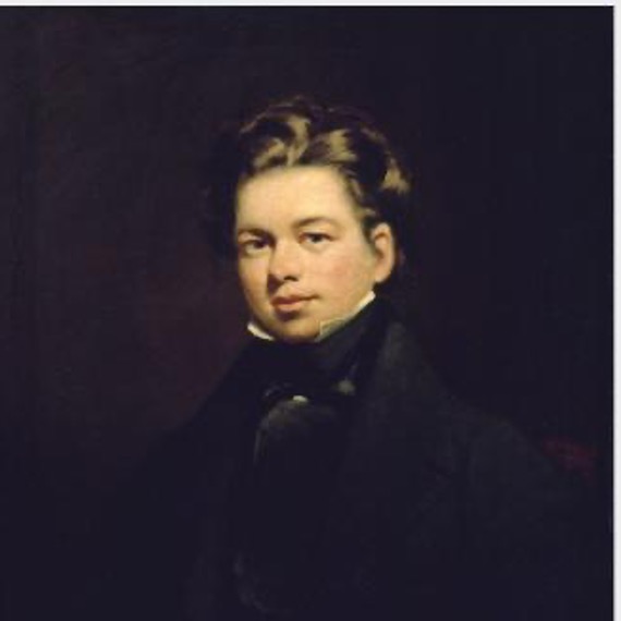
Born in County Kilkenny in 1806, O’Donovan was educated through the hedge-school tradition. There he learned Irish and Latin and developed skills of careful reading and transcription that would shape his later work. As a young man he joined the circle of Irish scholars around the Royal Irish Academy, working under the antiquarian James Hardiman.
By the time Thomas Larcom had employed O’Donovan in 1830, the Survey had already encountered a problem that measurement alone could not solve. Ireland’s place-names existed in multiple forms at once. Spoken Irish varied from district to district; anglicised spellings differed across maps and estate records; older forms survived unevenly in manuscripts and annals. Yet a single standardised name in English was required for each place so that it could be fixed onto an engraved map sheet and used consistently throughout government.
O’Donovan’s role was to help resolve the confusion and uncertainty that surrounded place-names. He began in archives and libraries, tracing names through manuscripts, annals, and earlier records. It soon became clear, however, that documents alone could not settle the matter. The surviving landscape of Irish speech still carried pronunciations and meanings that had never been fully captured in written form.
So, from 1834 onward, O’Donovan travelled extensively throughout Ireland, often on foot or horseback, seeking out Irish-speaking informants, recording pronunciations, traditions, and local explanations of place. His letters to Thomas Larcom preserved more than technical details: they also captured fragments of local history, folklore, genealogy, and insightful social observation gathered in the years before the transformations that followed the Great Famine.
He worked between written record and living speech. Ancient manuscripts might preserve an older form of a name; local pronunciation might preserve a different one. Estate usage, church records, and administrative convenience introduced further complications. O’Donovan weighed these competing claims and advised upon the forms that would appear on the maps.
The Survey did not attempt a complete restoration of Irish names in their historical form. Nor did it invent new place-names. But it was required to provide a nomenclature capable of functioning within an English-speaking administrative system. O’Donovan therefore acted less as a restorer than as a mediator between languages. He sought forms that retained something of their Irish origin while remaining usable within official administration. The result was often a compromise between scholarship, pronunciation, and practicality.
Those compromises carried consequences. The work extended across thousands of townlands and place-names, with the name books recording variants and sources; O’Donovan’s letters supplied explanation, argument, and judgment. Yet once transferred to engraved sheets, the chosen forms acquired a new authority. Variations that had coexisted for generations were reduced to a single official version. The map preserved names, but it also stabilised and simplified them.
The Survey’s investigations created an extraordinary archive of pre-Famine Ireland. Under George Petrie’s Topographical Department, O’Donovan contributed to a wider project that sought to document not merely geography, but antiquities, language, genealogy, and local society. Although the proposed county memoirs were eventually abandoned, much of the material survived in the letters, name books, and manuscripts produced during the survey itself.
Beyond the Survey, O’Donovan’s editions and translations of Irish historical texts, particularly the Annals of the Four Masters, established his lasting reputation in Irish historical and linguistic scholarship.
His letters reveal a man attentive to detail, impatient with error, yet deeply curious about people, places, memory, and speech. He moved easily between manuscript scholarship and conversation with labourers, fishermen, priests, and storytellers. He occupied an unusual position within the Survey itself, as an intermediary between Irish and English, soldier and civilian, between oral tradition and written administration, between inherited memory and the modern state.
Brian Friel later drew extensively upon O’Donovan’s letters in writing Translations, yet admitted that he could “never quite make up [his] mind” about him. Friel recognised in O’Donovan a profound ambiguity: a sympathetic recorder of a fading Gaelic world who nevertheless helped translate that world into the fixed language of a modern administrative system.
That ambiguity lay at the centre of O’Donovan’s work. He helped preserve fragments of Ireland’s older linguistic landscape precisely by participating in the process that standardised, reduced, and incorporated it into the authority of the modern map.
By the time of his death in 1861, the names upon which O’Donovan had advised had become embedded in the cartographic and administrative record of Ireland. Yet the tensions underlying them never entirely disappeared. The forms preserved on the maps could not fully contain the meanings, pronunciations, associations, and memories carried within local speech, but thanks to him, their roots and derivation were recorded.
Sources:
Dictionary of Irish Biography: https://doi.org/10.3318/dib.006718.v1 (content is licensed under a Creative Commons Attribution Non Commercial 4.0 International license).
Friel’s foreword to Ordnance Survey Letters Donegal. Ed. Michael Herity, Four Masters Press, Dublin, 2000.
By subscribing, you will be notified of new posts.

Response
[…] leadership; Thomas Drummond, scientific ingenuity; Thomas Aiskew Larcom, organisational discipline; John O’Donovan, scholarly authority; and Richard Griffith, expertise that extended into geology, valuation and […]
LikeLike