Royal Engineer whose defining ability was to turn the separate worlds of surveying, cartography, naming, and administration into a coherent and coordinated system. That capacity defined every phase of his career.
A companion essay to “Names on the Map: Authority, Language and the Ordnance Survey”
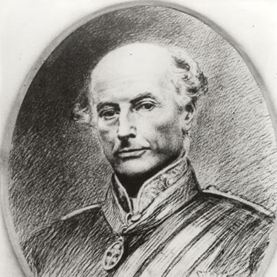
Thomas Aiskew Larcom was not the most celebrated figure of the Irish Ordnance Survey, nor its most visible scientific mind. Yet he became its organiser and integrator. Where others measured, he coordinated; where others observed, he imposed structure. Through his work, the Survey in Ireland became not merely a technical and scientific achievement, but part of the administrative machinery through which the country could be understood and governed.
Born in Hampshire into a naval family, Larcom trained at the Royal Military Academy, Woolwich, and joined the Royal Engineers in 1820. Early service in Gibraltar and Britain gave him practical experience in engineering and surveying, but it was his transfer to Ireland in 1826 that defined his career. By the late 1820s, he had assumed responsibility for preparing and publishing the six-inch maps. Formally, this placed him in charge of engraving; in practice, it placed him at the centre of the entire enterprise.
Among the remarkable Royal Engineers employed by the Ordnance Survey, Larcom stood out for his unusual combination of scientific, engineering, and organisational ability. That combination quickly made him indispensable at Mountjoy Barracks.
The Irish survey was vast, intricate, and, at the outset, only loosely coordinated. Larcom brought it into order. He divided production into specialised branches: compilers, draughtsmen, engravers, printers, and examiners, and integrated them into a coordinated system capable of producing precise and consistent maps at a national scale.
His role extended well beyond office-bound map production. He oversaw the integration of field survey operations carried out by the Royal Engineers, the boundary work undertaken alongside Richard Griffith’s valuation survey, and the topographical and linguistic recording conducted by scholars in the Topographical Department. Military engineers, civilian surveyors, engravers, draughtsmen, antiquarians, and Irish scholars were brought into a single administrative system, each dependent on the work of the others. Under Larcom, these separate specialisms became parts of a coordinated national survey.
He also recognised a problem that could not be solved by military surveyors alone: the uncertainty of Irish place-names. Ireland’s toponymy was inconsistent, fragmented, and often contested. Local pronunciation, documentary evidence, and official usage frequently diverged. Larcom initially attempted to engage directly with the problem, even learning Irish himself, but he quickly recognised the limits of amateur scholarship.
His response was characteristically pragmatic. In 1830, he brought John O’Donovan into the Survey, and together they developed a system that balanced field usage, historical sources, and administrative practicality. Ancient manuscripts, local pronunciation, estate records, and oral testimony were weighed against one another before a standard English form was selected for official use. As Larcom later described it, the objective was not a complete restoration of older Irish forms, but a workable compromise between scholarship and practical administration.
This approach reflected Larcom’s broader commitment to standardisation. Under Larcom, the Survey developed systematic procedures for recording names and resolving ambiguity. Where several forms existed, decisions had to be made; once fixed on the engraved sheets, those decisions acquired official permanence. What distinguished Larcom was his ability to turn principles of classification and consistency into functioning administrative practice.
His ambitions for the Survey extended further still. He envisaged the Ordnance Survey as a comprehensive account of Ireland: not merely its geography, but its history, economy, language, and society. That wider vision found expression in the Ordnance Survey Memoirs and in the work of Petrie’s Topographical Department. The project was intellectually ambitious but politically sensitive and financially burdensome. In the end, it was curtailed, revealing both the scale of Larcom’s vision and the limits of what government was willing to sustain.
By the 1840s, Larcom’s work was already moving beyond surveying into the wider machinery of government, and his methods remained strikingly similar. As census commissioner from 1841, he applied the same principles of classification and systematic record-keeping to population statistics. He supported structured occupational categories, thematic mapping, and the use of statistical evidence as an instrument of government. His involvement with the Dublin Statistical Society reflected the same conviction that effective governance depended upon organised and reliable information.
During the famine years, Larcom moved into the Board of Works, where he applied his detailed geographical knowledge of Ireland to the organisation of roads, drainage, and relief schemes. The transition from survey administration to state administration was, in many respects, a continuation of the same habits of coordination and control.
Around this time, his relationship with Thomas Colby deteriorated. Colby became increasingly wary of Larcom’s growing independence and prominence; the six-inch maps were widely known as “Larcom’s maps.” The tension culminated in Larcom’s departure from the Survey in 1848, though it did little to diminish his reputation.
In 1853, Larcom became Under-Secretary for Ireland, the most senior permanent civil servant in the administration, a position he held for sixteen years. Through successive governments, he provided continuity in the management of Irish affairs. His methods remained consistent throughout: governance, in his view, depended upon accurate information, systematic reporting, and administrative coordination. He governed less through public rhetoric than through memoranda, statistics, and institutional control. His influence extended across policing, poor law administration, local taxation, public health, and official reporting on agriculture, crime, and social conditions.
During the rise of Fenianism in the 1860s, he supported intelligence gathering, arrests, and the suspension of habeas corpus as part of the state’s response to revolutionary Irish nationalism. The complexity of his position was reflected in his personal relationship with the family of John O’Donovan, whose sons later became involved in nationalist activity and on whose behalf Larcom quietly intervened.
He retired in 1868, his health weakened but his standing intact. He was created a baronet and appointed to the Irish Privy Council. In retirement, characteristically, he devoted himself to arranging his papers and records. He died in Hampshire in 1879.
Larcom’s career followed a clear progression: from engineer to organiser of knowledge to administrator of the state. The methods remained remarkably consistent throughout. The principles of classification, standardisation, coordination, and recorded information that he applied to the Ordnance Survey later became the principles through which he governed.
He was unusual in having not only helped to map Ireland, but also helped construct the administrative systems through which the country was subsequently understood and managed.
Sources:
1. DICTIONARY OF IRISH BIOGRAPHY: https://doi.org/10.3318/dib.004679.v1 This content is licensed under a Creative Commons Attribution Non Commercial 4.0 International license.
2. J. H. Andrews, A Paper Landscape: The Ordnance Survey in Nineteenth-Century Ireland, (1975).
By subscribing, you will be notified of new posts.
