Published 10 January 2026
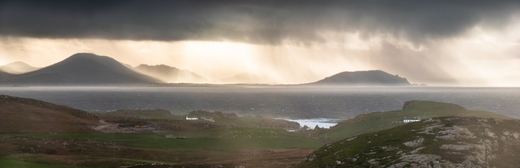
Photo: MJ Cory
Malin Head is further north than where the iceberg sunk the Titanic. It’s even further north than the sub-arctic capital of Siberia, and only the Outer Hebrides and the Faroe Islands lie between it and the North Pole. Although the Gulf Stream keeps temperatures relatively mild, storms build up across thousands of kilometres of the Atlantic Ocean to the west, and hurricane-force winds and 14-metre-high waves batter the coast. Standing on the cliffs, it feels “ludicrously remote and bleak”. [1] But when the sun shines on the white-flecked turquoise ocean waves, backed by the green hills of Donegal, there is a freshness in the air and the landscape glistens. The scenery is stunning. Overhead, the stars are spectacular, the Northern Lights are occasionally visible, and satellites race across the heavens. Standing at the very northern point of Ireland, one cannot help but contemplate the nature of the world, its size, its shape, and man’s place in it
Ptolemy called this place “Boreom”, which translates as “The Northern”. [2] His map is one of the earliest that locates Ireland, squashed into the top left-hand corner at the edge of the known world, too far north, too far west, and too fat, but it is recognisably Ireland. [3] His work, and that of Mercator, Copernicus, Newton, and others, provides the foundation for mapping Ireland. This endeavour has its roots in Greek philosophy, the Enlightenment, and the consequent scientific revolution.
How our ancestors first noticed that the earth must be round is unknown. They may have noticed that different stars were visible in the sky from various locations and that they rotate above them in the heavens. Ship’s hulls disappeared over the horizon before their sails did, and the sun rose in the east and set in the west. The Phoenicians probably sailed south of the equator and perhaps around the Horn of Africa, where the sun moved into the northern hemisphere. Travel, as it does today, fed their curiosity and encouraged discovery.
Alexander the Great’s conquests collected information about far-off lands, held in his great library in Alexandria. The Chief Librarian, Eratosthenes, made a map of the world in 194 BC based on this information, and although the original is now lost, it was reconstructed in the nineteenth century. On it, we see the first use of parallels and meridians, referenced to the Island of Rhodes, and north is at the top. The map extends further east to west than north to south, giving it a ‘squashed’ appearance; the further east or west, the greater the distortion. Looking at it, travellers must have speculated about what existed beyond the far reaches of the known world and wondered about the actual size and shape of the Earth.
To the Ancient Greeks, the heavens formed a sphere within which another sphere, the Earth, is centred. Latitude was the sun’s angle above the horizon at midday when it crossed the observer’s meridian, or the angle of the pole star, around which it was thought the cosmos rotated. Locations with the same length of time on the longest day of the year sat on the identical parallel or latitude, defined by the length of the longest day in units of quarter hours. Meridians of longitude were based on the hour at which an astronomical event (such as a lunar eclipse) was visible at two locations simultaneously, providing a time difference between the two locations. Pythagoras first suggested that the earth was a sphere, but the question was, how large was it?
Eratosthenes was the first to apply a scientific approach to determining the Earth’s size. He had noticed, or was told, that on mid-summer day, the sun shone directly overhead, casting no shadows at a place called Syene in Egypt, and yet on the same day in Alexandria, 5000 stadia (800 km) to the north, it shone at an angle, casting a shadow. Using a Gnomon, a form of sundial, he measured the length of the shadow and determined the sun’s angle from the vertical. From this angle (7.2 degrees) he used basic geometry to determine that the angular distance at the centre of the Earth would be the same, that is, 1/50th of the Earth’s circumference, making the complete circumference of the Earth 40,000 km. Although he had assumed the earth was a sphere and that the distance between Alexandria and Syene was correctly measured and on a meridian, his calculation was a remarkable one, very close to its actual length of 40,075 km. [4] This suggested that there was a lot more of the Earth to be discovered than appeared on his map.
Today, Eratosthenes is considered the father of geodesy. His principles, such as looking to the heavens to determine positions on the earth and measuring distance on the earth to calculate its size, have guided geodesy, surveying, and mapping to this day.
Alexandria’s library remained at the centre of science and learning into the second century AD when Claudius Ptolemy established a systematic and scientific approach to cartography. He compiled an index of places and their locations, developed fundamental principles of cartography, drew several maps and left instructions on how to do this. His fundamental principles remain relevant today: a knowledge of the size and shape of the earth in the area to be mapped; working from the whole to the part; establishing a reference datum; mapping a location according to its “just proportions” (scale); and the use of a global reference system of latitudes and longitudes from astronomic observations, prioritising these over travel times between locations. He described two map projections, one “inferior and easier” and the other “superior and troublesome”, neatly summarising the challenges of map projections that still apply. Ptolemy’s book on cartography is the only one known to have survived the Classical period, and it remains one of the most influential scientific works of all time.[5]
Ptolemy’s gazetteer, principles, instructions and maps were lost to Europe for a thousand years after the destruction of the library at Alexandria in 391 AD. Their knowledge continued in the Arab world, having been translated from Greek into Arabic in the 9th Century. Muslim scholars in the 9th Century agreed that the earth was spherical and used it to calculate the distance and direction of Mecca from anywhere on Earth (“Qibla”), developing spherical trigonometry to help in these calculations. When Ptolemy’s work was “rediscovered” in 1407, it revolutionised European mapmaking, heralding a new age of discovery.[6]
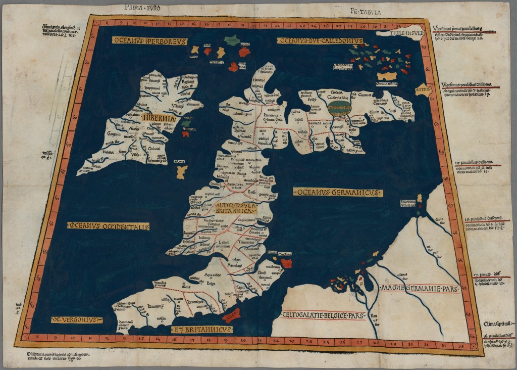
Ptolemy’s map of Britain and Ireland.
Ptolemy, and Johann Reger. “Prima Europe tabula [cartographic material].” Ulm: Johann Reger 1486, Print. Reproduced courtesy of the National Library of Wales.
[1] “Ireland with Simon Reeve”, BBC TV available online at https://www.bbc.co.uk/programmes/b06r0xn2 accessed 20/3/2024.
[2] Although the name “Boreom” could equally refer to Bloody Foreland or Rossan Point: “Ptolemy’s map of Ireland: a modern decoding” R Darcy & William Flynn, 2008, Irish Geography 41:1, 49-69.
[3] Ptolemy referenced latitude and longitude from the “Isles of the Blest”, thought to be the Canary Islands. Ireland lies approximately 6 degrees too far north, 4.5 degrees too far west and it extends 8 degrees east to west, instead of 5 degrees.
[4] According to NASA. “Imagine the Universe” https://imagine.gsfc.nasa.gov/features/cosmic/earth_info.html# accessed 20/3/2024.
[5] “Ptolemy’s Geography: An Annotated Translation of the Theoretical Chapters”. Berggren and Jones, Princetown University Press, 2000.
[6] The transmission of Ptolemy into Europe began with the Latin translation by Jacopo d’Angelo (c.1360-1410) in 1409/10. The maps were revised by Nicolaus Germanus (fl. 1451-1456), a German Benedictine monk. Source: Digital Bodleian: https://digital.bodleian.ox.ac.uk/about/ accessed January 2023.
