The ordinary soldiers who mapped Ireland: their skills, inventions and achievements, and the opportunities, hardships and dangers they faced..
The names of the officers who directed the Ordnance Survey appear on its maps and in its official histories. Much less was written about the soldiers who carried out the work. Yet among the Sappers who measured Ireland were men of considerable ingenuity and skill, often from humble backgrounds. Some of them developed new methods, some invented instruments, others became accomplished technical specialists. Their individual stories offer a different perspective on the men on the Survey who made its maps. [i]
One was Sergeant Alexander Doull. Officers sought Sergeant Doull’s advice on difficult surveying problems. He had become an accomplished surveyor and draughtsman, trusted with a twelve-inch theodolite for the secondary triangulation. He was the chief non-commissioned officer during the measurement of the Lough Foyle baseline, helping to carry out one of the Survey’s most exacting measurements on the plain at Magilligan and Moy. At Rathmelton, in Donegal, he devised a faster method of surveying and invented a plotting scale. Later, he developed a reflecting instrument. When Doull left the military in 1838, after twenty-three years’ service, he applied the skills he had learned in Ireland in civilian life, working on Tithe Commutation surveys in England.
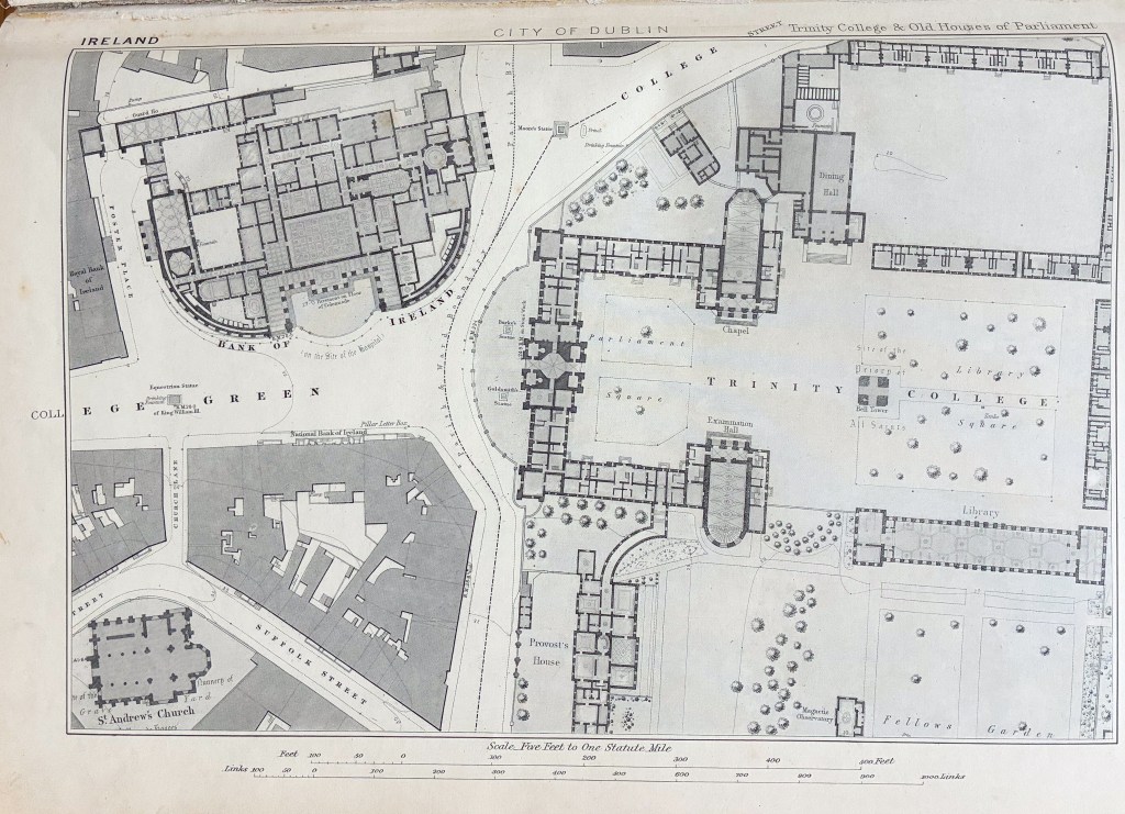
Colour-Sergeant John West was another Sapper whose technical abilities earned him recognition and standing. He became an outstanding engraver whose work included county index maps and the 1839 geological map of Ireland. He helped engrave the city sheet of Dublin depicted in the header image of this post. Another, Sergeant Robert Spalding, acquired such expertise in surveying that he was sent to Chatham to teach surveying to younger Sappers and wrote a manual for their instruction. Then there was Lance-Corporal Andrew Duncan who devised an improved method of making Gunter’s chains, the historic surveyors’ measurement tool. One unidentified Sapper invented a computing scale described as “a beautiful and simple contrivance” for calculating areas on a map. His name is not recorded, only the fact that he received 6d a day extra pay for the remainder of his service. [ii] Many others remain unidentified, occasionally emerging as someone’s ancestor and as inspiration for fictional accounts of the Survey’s work in Ireland.
The attraction of service in the Ordnance Survey continued long after Colby’s time. Writing anonymously in The Sapper in 1895, one soldier described the opportunities it offered recruits sent to Southampton, Dublin or Edinburgh to learn their trade. Besides better pay and what he called its “semi-civil life”, he believed Survey work would “improve his knowledge and intelligence”, while testing abilities that few other military duties demanded. [iii]
The Calculating Boy
William Young was not the only young mathematician whose abilities attracted attention within the Ordnance Survey. In October 1841, the Yorkshire Gazette reported on an extraordinary eight-year-old boy from Derry named Alexander Gwin. He had astonished his colleagues with his remarkable mathematical abilities and became known as the “Calculating Boy”, committing to memory the fractional logarithms of every number from one to a thousand. He could recite them, apparently without hesitation, in whatever order he was challenged.
His talents extended beyond feats of memory. According to the newspaper, he could calculate trigonometrical distances and solve problems involving triangles with exceptional speed and accuracy. Given the distances measured by a surveyor’s chain, he could calculate the area of a parcel of land in acres, roods and perches in less than a minute, a task which, the report claimed, might occupy an experienced mathematician for nearly an hour. [iv]
Alexander’s remarkable childhood was the beginning of a longer association with the Ordnance Survey. He later joined the Royal Sappers and Miners, while his father and brother, both named Henry, also worked on the Ordnance Survey. The 1851 census records all three in Southampton, where the Ordnance Survey had established its headquarters. Yet Alexander’s story had an unhappy ending at an asylum in Salisbury, a poignant contrast with the public admiration that had greeted his mathematical gifts as a child.
For some Sappers, the dangers of the work were more immediate. Private Alexander Smith getting lost at night on the slopes of Slieve Snaght was recounted in an earlier Blog. Gunner Phibbs was hit by lightning on Cuilcagh Mountain. [v] But some fared worse. Private William Bennie drowned when a boat overturned while surveying islands in Strangford Lough. At Valentia Island, Private Joseph Maxwell was struck by a wave that swept away his notebook. While trying to recover it, another wave carried him from the rocks. His labourer, Conway, was also swept away trying to help. In all, twenty-nine men lost their lives on the Survey in Ireland. [vi]
The Survey drew upon a remarkable variety of abilities. Some men became accomplished mathematicians and surveyors; others made their names as engravers, draughtsmen or inventors. Their skills were not always reflected in their military rank, nor did all their careers end in distinction. For some, the work brought advancement and opportunity; for others, hardship and danger.
The Ordnance Survey of the nineteenth century demanded many skills besides soldiering, even more besides the science, mathematics and the ability to measure land. Next, we shall meet one Dublin-born soldier more accomplished with a drawing pen than a musket.
Footnotes
Header Image depicts the fine detail engraved by the Ordnance Survey and shows the five feet to one mile scale map of Trinity College and Old Houses of Parliament in central Dublin; from the Ordnance Survey’s Queen Victoria Jubilee Book held by Ordnacne Survey in Southampton. Photography by the author.
[i] T. W. J. Connolly, History of the Royal Sappers and Miners, 2nd ed., Vol. I (London: Longman, Brown, Green, Longmans, & Roberts, 1857). Connolly’s account, from which this section draws, is one of the few that does give information about the achievements of Sappers. It gives something that official histories often miss: the names, experiences and sometimes the voices of the ordinary soldiers who actually carried the work out.
[ii] Chris Higley, One-thousandth of an acre: the measurement of areas, Sheetlines No.120, Charles Close Society, April 2021.
[iii] “Life on the Ordnance Survey,” The Sapper: Royal Engineers Monthly Journal, October 1895, reprinted in Sheetlines: The Journal of the Charles Close Society, no. 120 (April 2021), pp. 45–47.
[iv] I am grateful to John Bradley and Clive Boocock for providing me with information about Alexander Gwin and a copy of the article in the Yorkshire Gazette, 30 October 1841.
[v] See Blog Post 22. The Surveyors on the Summits
[vi] T. W. J. Connolly, History of the Royal Sappers and Miners, 2nd ed., Vol. I (London: Longman, Brown, Green, Longmans, & Roberts, 1857), p. 410.
By subscribing, you will be notified of new posts.

Leave a Reply
You must be logged in to post a comment.