The general tranquillity of Europe, enables the State to devote the abilities and exertions of a most valuable corps of officers to an undertaking, which, though not unimportant in a military point of view, recommends itself more directly as a civil measure.”
Spring Rice Committee’s report, concluding remark. [i]
Military Origins
William Young’s career had been made possible by an organisation whose origins lay in an earlier century. The roots of both the institution and its name lie in the Board of Ordnance, a British government department established in Tudor times. Responsible for military lands, fortifications and the supply of weapons and equipment, it employed military engineers and civilian specialists under the authority of its Master General.
The idea for a national survey emerged following the defeat of the Jacobites at Culloden, in 1745. The British government recognised that reliable maps of the Scottish Highlands would help strengthen military control. Lieutenant Colonel David Watson was authorised to undertake a survey and recruited a young civilian surveyor-draughtsman, William Roy, to carry out the work.
The Highland survey was never completed, but Roy was commissioned into the army and went on to advocate for a national survey of Britain at public expense. His later work on the Anglo-French triangulation, linking Greenwich and Paris, helped establish the scientific foundations for accurately measuring and mapping the country. [ii]
After Roy died in 1790, the Master General of the Board of Ordnance, the Duke of Richmond, used the Board’s authority and resources to establish the national survey Roy had envisaged. The Board brought together the scientific expertise and manpower needed to undertake the national programme. Military officers would direct the triangulation, while civilian surveyors and draughtsmen would carry out much of the detailed mapping.
By 1824, when the Duke of Wellington, as Master General, entrusted Thomas Colby with the Survey of Ireland, this combination of military organisation and civilian expertise was well established. In Ireland, Colby would develop the military approach to the work even further.
The Sappers in Ireland
The Survey of Ireland was undertaken primarily to meet civil and administrative requirements, as the Spring Rice Committee had recommended. Yet Wellington insisted that it should be organised as a military survey, and Colby was determined to employ soldiers rather than rely on established civilian surveyors.
Colby regarded a national survey as fundamentally different from conventional estate surveying. The entire country had to be surveyed rapidly and to a uniform standard of accuracy. His experience with civilian surveyors in England suggested the need for greater control and the need to apply rigorous quality standards. He believed that soldiers, accustomed to military discipline and military orders, could be trained in common methods more readily than civilian surveyors used to doing things their own way.
Officers were drawn from the Royal Engineers and Royal Artillery, while the skilled military labour came from the Royal Sappers and Miners, formerly the Royal Military Artificers. On 1 December 1824, the 13th Company of the Royal Engineers was formed specifically for the Irish Survey. Its men were selected from the “most intelligent of the corps” and specially trained at Chatham under Lieutenant-Colonel Charles Pasley.
The first detachment, a colour-sergeant and twenty men under Lieutenant Edward Vicars RE, arrived in Dublin in March 1825. From Mountjoy Barracks they moved to Dromore, before dispersing in small parties to Antrim, Belfast, Coleraine, Dungiven and Londonderry. [iii]
The Survey expands across Ireland
Following the success of the 13th Company, Wellington authorised two more Survey Companies during 1825. By December, 129 Sappers were serving in Ireland, with another 61 training at Chatham. By 1831, their combined strength had reached 268.
Colby wanted capable men and was given exceptional authority to reward them. A Sapper could earn up to two shillings a day according to his “attainments and exertions”, considerably more than the normal working pay of sixpence to one shilling. Technical competence could bring rewards not ordinarily available to soldiers of similar rank.
The Survey Companies were unusual military units. Their men worked in small detachments, often in remote country and away from direct supervision. Major-General Sir James Carmichael Smyth, inspecting the companies in 1827, remarked upon the exceptional circumstances in which a Survey Sapper was frequently “left to himself”. The work required judgement, initiative, and discipline.
Colby’s insistence on using soldiers to follow his “system” attracted criticism and in 1827, an experiment compared the work of military and civilian survey parties in similar districts to see which was more efficient. The military parties were reported to have progressed more rapidly and at lower cost. The pressure to accelerate the Survey however increased and eventually forced Colby to compromise.
Major Reid, officer commanding at Mountjoy Barracks, took matters into his own hands and began recruiting civilian assistants and labourers behind Colby’s back. Reid, who had served with Wellington abroad, was prepared to challenge Colby’s authority. Faced with the need to accelerate the Survey, Colby relented, although he insisted that civilians remain under military supervision. Colby later had Reid removed from Dublin on a pretext. [iv]
The workforce expanded considerably, and at its height, some 2,100 civilians were employed on the Irish Survey, working alongside the soldiers. Sergeants and corporals frequently supervised smaller groups, while officers directed the larger operations. The military establishment had become responsible for a substantial civilian workforce.
Something of this organisation can be reconstructed from the records of the 1836 Survey in County Meath. Captain Bordes RE was in overall charge of the district. Captain Stotherd and Lieutenants Greatorex and Chaytor were encamped on Sliabh na Caillighe, in the Loughcrew hills, engaged in triangulation. Lieutenant Edward Bennett directed the topographical survey below. [v]
Although the published sheets carried the names of officers such as Bordes and Bennett, much of the work was performed by men whose names rarely appeared. Soldiers and civilians measured the land, established survey stations, made observations and prepared the drawings from which the maps were produced. These were only the beginning. Observations had to be calculated and checked, boundaries and topographical detail drawn, and the results passed to engravers, writers and ornamentors who prepared the finished six-inch maps.
Colby’s Survey operation had become a dispersed technical organisation in which soldiers of modest rank exercised considerable responsibility. William Young, whose story opened this chapter, was one of these. Other Sappers developed their skills and acquired expertise, undertaking work far beyond the conventional duties of the Army’s rank and file. They were also living and working among the Irish people, often in remote communities far from their barracks and military supervision, in daily contact with the country the Ordnance Survey had been sent to measure.
Footnotes
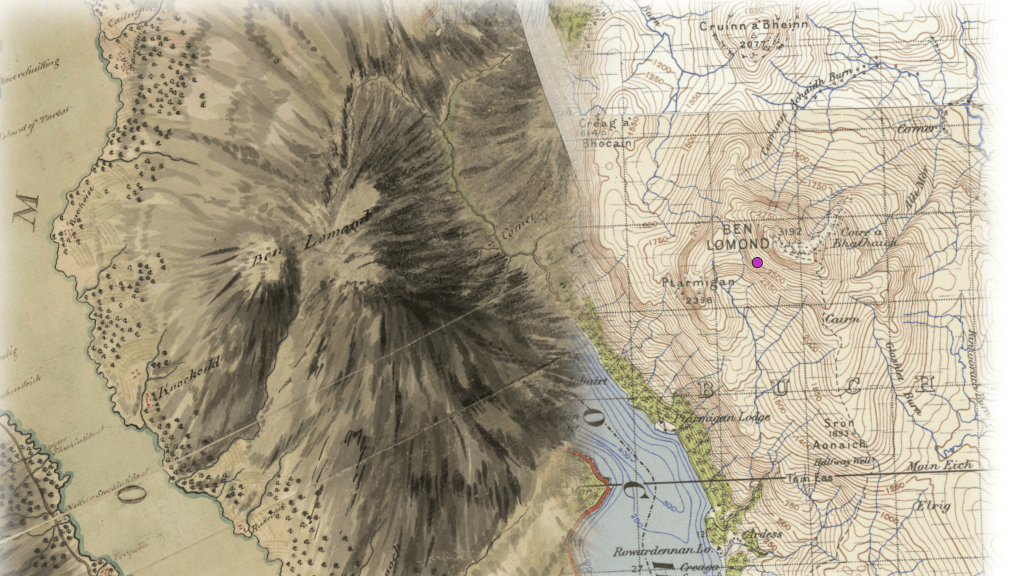
Header Image: Detail of Ben Lomond from Roy’s Military Map of Scotland (1747-1755); alongside OS One-Inch (1945-1948) of the same area two hundred years later. Source map images courtesy of the National Library of Scotland. Reuse by CC_BY (NLS). See https://maps.nls.uk/
[i] “Extract from the report of the Select Committee of the House of Commons dated 21st June 1824, recommending that a Trigonometrical Survey of Ireland should be carried out by the Board of Ordnance for a map on the 6-inch scale”, NA HO 45/20521.
[ii] See “La Différence”
[iii] Much of this section is based on T.W.J. Connolly, History of the Royal Sappers and Miners, Longman, Brown, Green, Longmans, and Roberts. London, 1857. Sourced from Project Gutenberg, accessed online 17/8/2026.
[iv] Reid had served with Wellington abroad and may have had Wellington’s ear and support. Tactfully, Colby relented, but he later had Reid removed from Dublin on a pretext, when he moved to take over operations himself. It did not slow Reid’s career – he went on to become Governor of Malta.
[v] OS200, Digital Repository of Ireland, First Edition Six-Inch Maps, County Meath; George Petrie, “On the History and Antiquities of Tara Hill”, Transactions of the Royal Irish Academy, vol. 18 (1839); National Library of Ireland, Headfort Papers, Additional Maps and Plans; Proceedings of the Royal Irish Academy, account of the Ordnance Survey observations at Sliabh na Caillighe, 1836.
By subscribing, you will be notified of new posts.
