Life along the baseline in 1830.
(Continued from the previous post: 14. Measuring the Base )
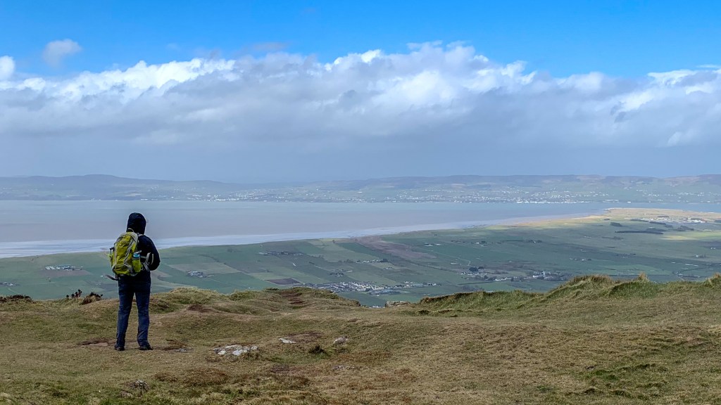
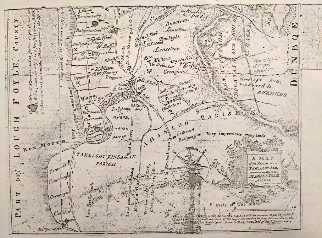
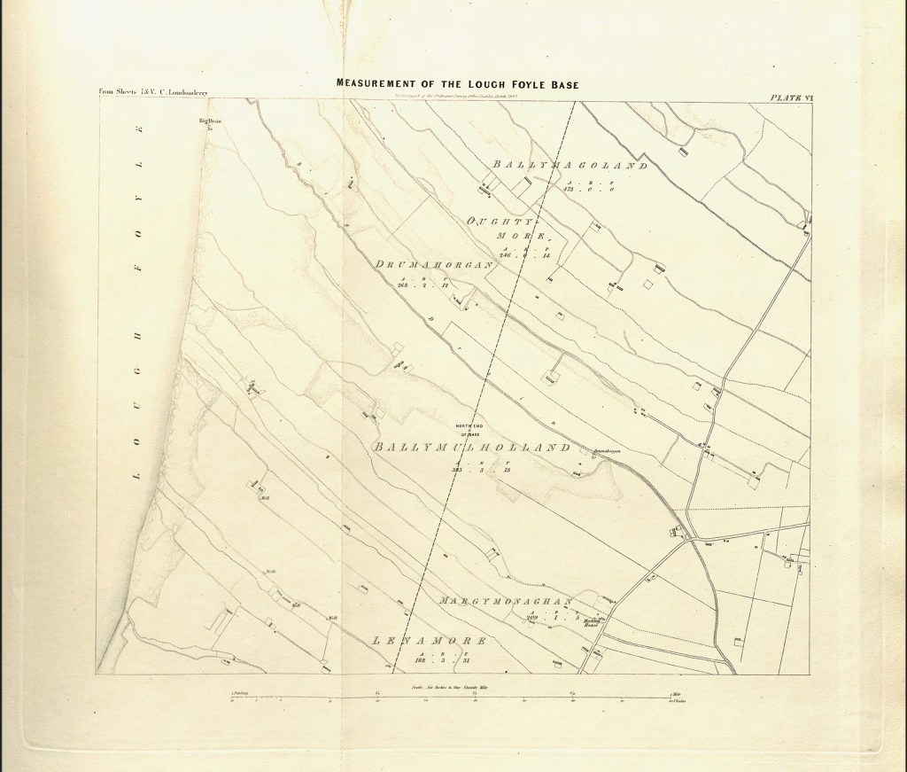
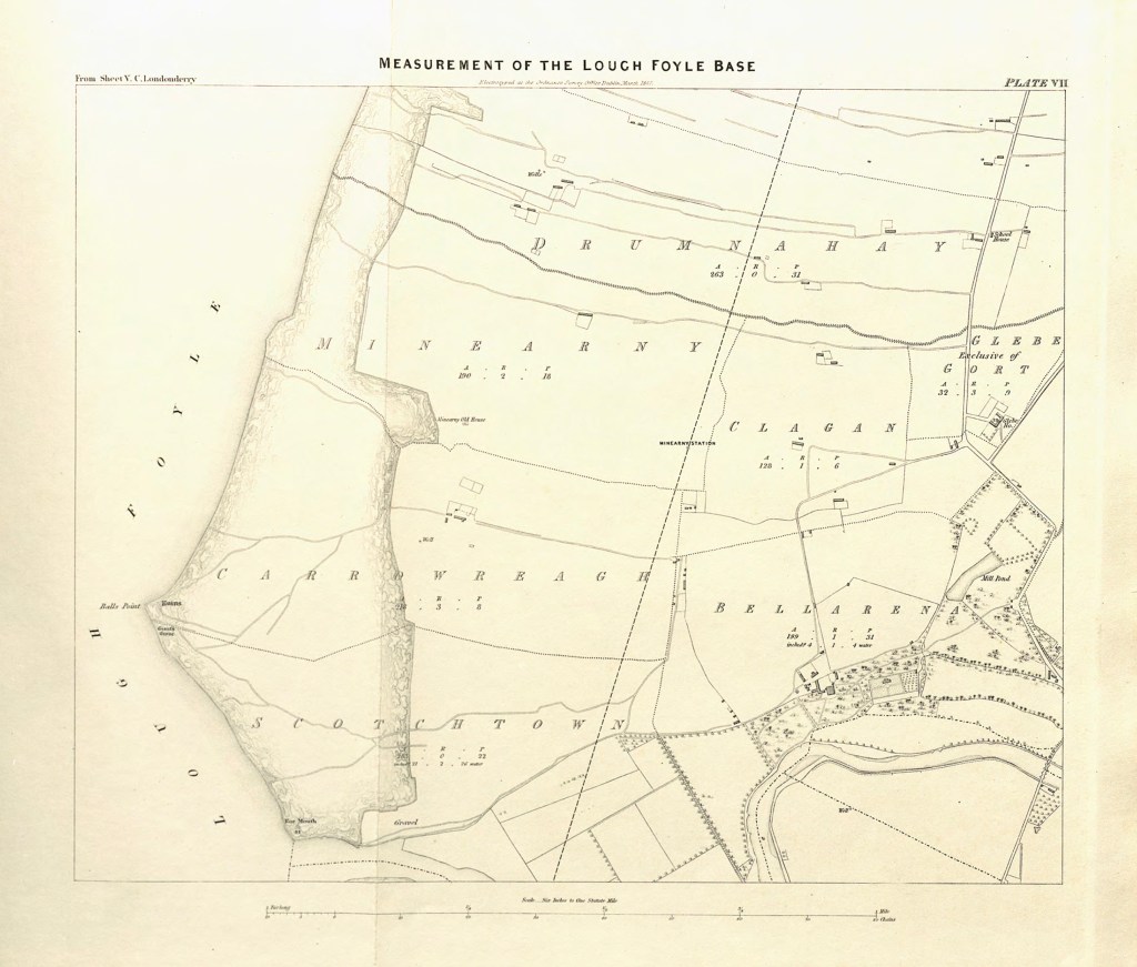
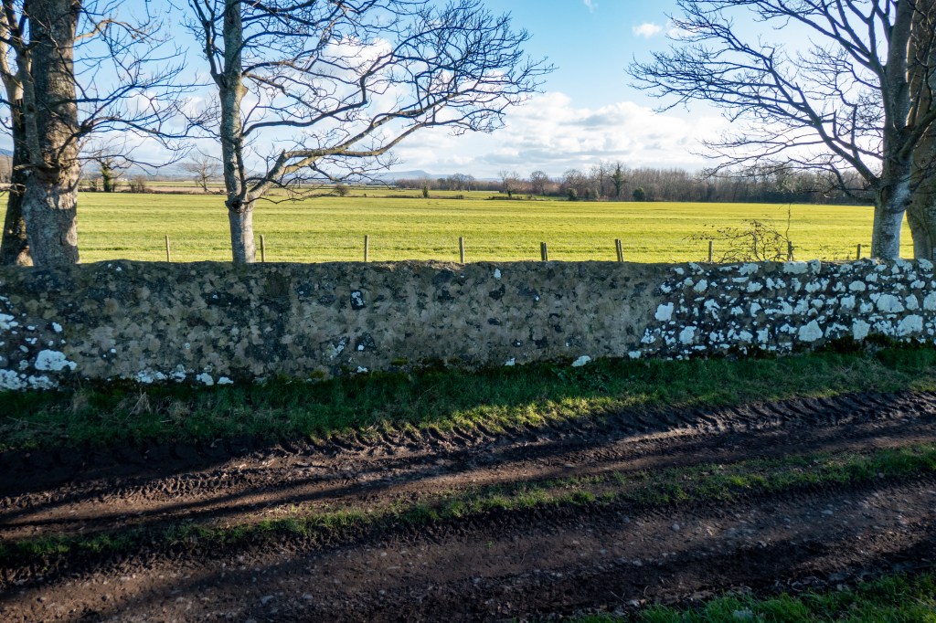
When the surveyors arrived to measure the Lough Foyle baseline in the late 1820s, it wasn’t an empty landscape. Yes, it was wild, and if they had taken a ride around the coast, they would have found the wind and light working off each other, on one side the ocean wild with foam and glitter, and on the other, grass swaying amongst the dunes. [i] They found a land shaped by fire, water, ice and wind, and by centuries of settlement, farming, and folklore. Their six-inch maps captured the townlands with precision, and their Memoirs recorded the lives of the people who lived there. Together, they offer a glimpse of Magilligan and Myroe just before the upheavals of the nineteenth century.
The story of a place begins with what is written into the landscape.
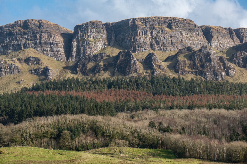
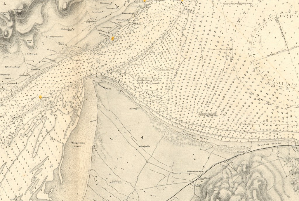
Volcanoes formed the mountain, the basaltic cliffs its signature. Lough Foyle once lapped against these cliffs, and below them, a stony ridge is all that is left of that ancient shoreline. The sea eroded with one hand and gave with the other. Inishowen was once so close that it was said a lamb could skip from Magilligan to Greencastle. Now they are two miles distant. A fairy living near the mouth of the Foyle on the Ton Banks had cursed the parish after her carpet was stolen. She declared that every year the breadth of the carpet would be swept away from the shore.
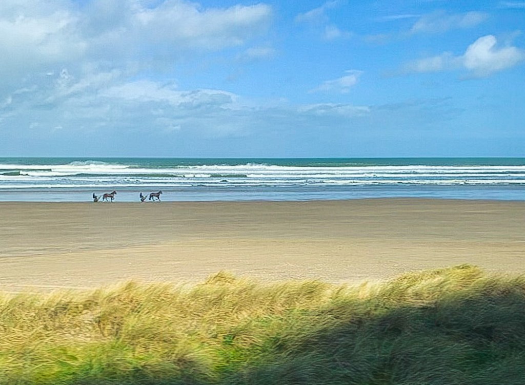
Erosion by the sea is joined by a wind that blows endlessly across the plain, constantly shaping and reshaping the dunes. Marram grass was planted to bind them and was harvested to make traditional brooms and matting. Two sand hills, known as the Bony Hills, exposed their buried human bones when the wind blew, or rabbits, disturbed them, the bones turning to dust and blowing away. These were the remains of the Gaelic clans defeated by a plantation force in 1642. It is the same wind that, blowing in 1827, disturbed the delicate baseline operation, requiring some remeasurement.
Beyond the dunes lay rich fishing grounds. The sea supported abundant stocks of cod, salmon, herring, flounder and oysters, yet the coast offered little shelter. Without proper harbours, fishermen launched their open boats directly from the beaches, rowing far out into the Atlantic before setting their lines. It was productive, but hazardous, particularly among the dangerous shifting sandbanks north of Magilligan Point. Around the year 1700, fishermen working the Ton Banks were caught in a sudden hurricane. All were pitched into the sea, and only one survived, clinging to a floating oar before eventually reaching the shore near Benone Strand. Exhausted, he lay recovering amongst the dunes, as his fellow fishermen wandered around him in ghostly silence, pale and bewildered. All had died, and by morning, it was said that sixty-five widows had been left in the parish.
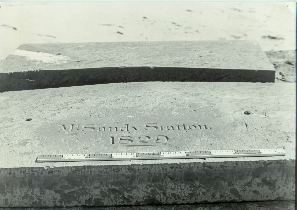
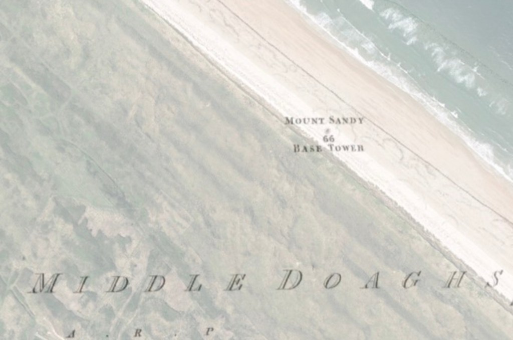
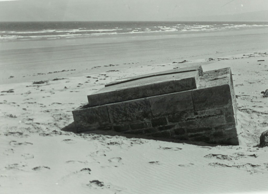
One of the baseline stations, Mount Sandy, was erected amongst these dunes; it too had been taken by the sea by the 1960s, taken by the ocean’s long rhythm in the swaying of the grass.
Wildlife was once abundant. Eagles haunted the cliffs, and the last wolf hunted from Binevenagh in 1743 and killed near Dungiven. Hares and badgers had ranged the uplands, but retreated as settlement expanded. Foxes were hunted for their pelts, a practice that had ended by 1768. By the time the Survey arrived, the sandy ground supported extensive rabbit populations, and rats were common. Thousands of rabbit skins were once exported to England, a trade that was already declining as agricultural land improved and cheaper materials became available.
The mountains, uplands and low valleys each supported different plants according to soil and elevation. It had many uses: soap substitutes, medicines for sore throats and stomach complaints, and remedies for fever and scurvy. It was a rural community still relying on inherited knowledge at a time when formal medicine was distant or unaffordable, the landscape itself an open-air pharmacy.
Although less fertile than the Roe Valley further inland, the Magilligan plain supported a mixed agricultural economy. Potatoes, oats, barley and wheat were grown, with seaweed and shells gathered from the shore to fertilise the soil. Small local industries served farming communities. Flax and corn mills operated in nearby townlands, and the many blacksmiths marked on the maps showed the reliance on the horse. Agriculture dominated employment, with hundreds of farms across the parish. The surveyors were careful not to disrupt their work and in 1828, they paused the baseline measurements for several weeks to allow the crops to be harvested. This was despite Colby himself being under pressure from London to complete the survey more quickly.
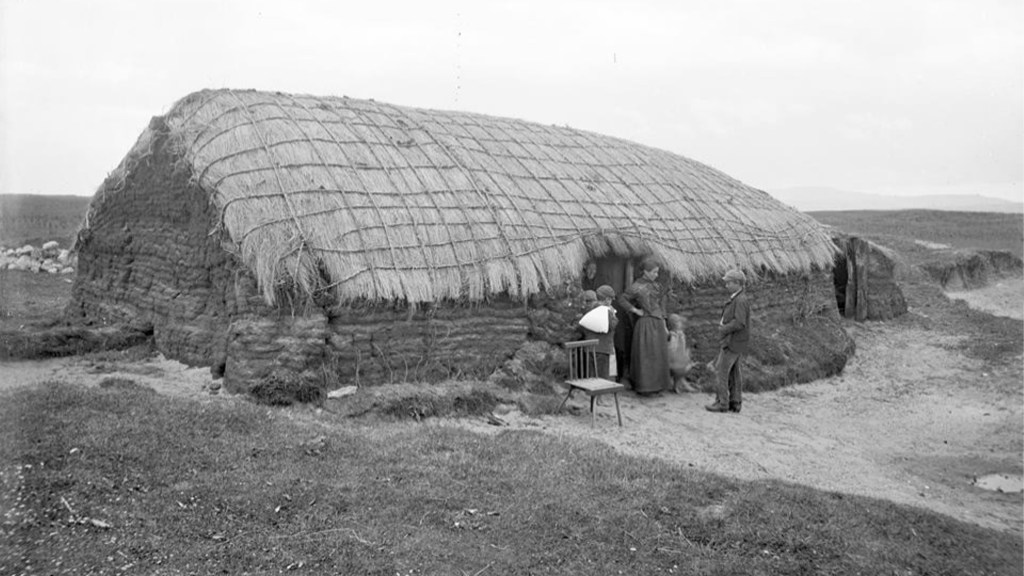
Housing on the Magilligan plain reflected the exposed environment. Wealthier residents lived in stone houses, often near the foothills of Binevenagh, while many others occupied cottages built from clay sods, turf and thatch. These simple homes were carefully aligned to withstand the prevailing winds, with one gable facing the uplands and the other the lough. At one point, during the baseline measurements, the line was found to pass through the corner of a cottage. To preserve the straightness of the line, the surveyors removed part of the building so their instruments could pass. The corner would later have been easily rebuilt.
The Sappers established their own accommodation , a camp near Bellarena House on the Connolly-Gage estate. The surrounding landscape reflected centuries of political change. Land once held by the Gaelic families had passed to new settlers after the Elizabethan wars and the Plantation of Ulster. Population patterns shifted repeatedly, with emigration balanced by labour arriving from nearby Inishowen. Two ferry boats still connected Magilligan with Inishowen in the 1830s, one for people, the other for livestock.
Place names reveal the deep history of the area. Duncrun means “fort of the Cruithin”, the Ancient Irish Cruithnigh, a people that existed in the area before St. Patrick. Myroe (Moyroe) came from the Irish Maigh Ró, meaning “plain of the Roe”, the low ground between Limavady and the River Roe probably reclaimed from Lough Foyle in earlier centuries. It is across this plain, and Magilligan north of the Roe, that the baseline was measured. Nearby stands the church of St Aidan at Tamlaghtard, a site with layers of history, from pre-Christian ritual, early medieval foundations and later church buildings. Local tradition associates it with St Aidan of Lindisfarne (d. 651), though historians remain uncertain about that connection.
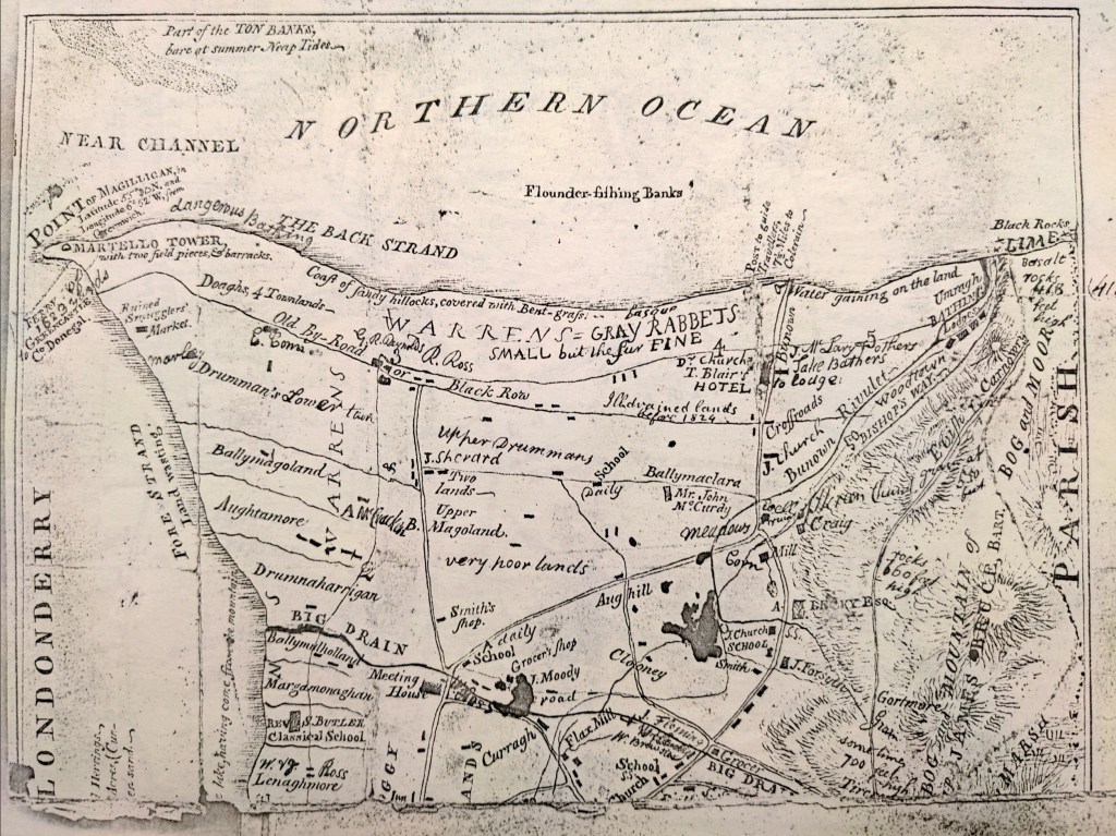
Reverend Butler had drawn his own map of the area just before the Ordnance arrived. It marks a “Classical School”, likely one of the informal hedge schools common at the time. Such schools brought together children of different religious backgrounds in a single room under a literate master, with families paying small fees. Pupils learned reading, writing and arithmetic, and sometimes Latin grammar.
A local story survives from one such school. Thomas Witherow, known for his poor handwriting, returned home in December 1834 to find an Ordnance Survey officer lodging at his father’s house. Seeing his writing, the surveyor offered to teach him. After twelve lessons, his penmanship had greatly improved. Some suggest the teacher might even have been Colby himself, though for this there is no firm evidence.
In 1833, the Reverend John Graham described the people of Magilligan as industrious and generous. The land and sea, he wrote, “teem with living creatures,” and the population shared in both the hardships and the rewards of that abundance. Despite modest means, rents and taxes were paid, hospitality was widely practised, and “no beggar refused alms in any house that has a potato to spare.” Notably, there are no reports of serious difficulties between the local population and the Sappers measuring the baseline. While some minor resistance to the Ordnance Survey occurred elsewhere in Ireland, nothing of that kind appears to have happened in Magilligan.
So, the Royal Engineers and Sappers advanced unimpeded. The six-inch maps and the Memoirs capture a particular moment in time. They describe its topography, fields, houses and livelihoods just before the upheavals that would transform rural Ireland. And from this short, measured line, the Survey spread across the island.


The next part of the story explores the legacy of that measured line, from the dunes of Magilligan to the global systems that map the world today.
Footnote and Sources
The above is based on:
- The Ordnance Survey Memoirs.
Only one memoir was published at the time, the Templemore Memoir, before the project was abandoned on account of the cost. Yet the field work for many areas had been completed, and the records kept, to be published later, including the notes that deal with Magilligan, the northern area of the baseline, on which this article is based.
“Ordnance Survey Memoirs of Ireland. Parishes of Co. Londonderry III 1831-5 Roe Valley Lower Vol 11”. Edited by Angelique Day and Patrick McWilliams. The Institute of Irish Studies, The Queen’s University of Belfast. 1991. - This article is also based on the survey carried out by Reverend Samuel Butler Just before Colby arrived: “A Statistical account of the parish of Tamlaght Ard commonly called Magilligan of Londonderry Diocese of Derry by the Revd Samuel Butler M.A. Dated Magilligan 5 October 1824.” PRONI T3239
- I am also grateful to the work of a small team in the Mapping Monuments project, a community heritage and research project that explored the landscape legacies of the Ordnance Survey in and around Binevenagh and the coastal lowlands of Lough Foyle. The presentation and notes by Bridgeen Rutherford on everyday life in the Magilligan–Binevenagh area of County Londonderry during the early nineteenth century were particularly helpful in preparing this article. For more information, see: https://storymaps.arcgis.com/stories/8acecb988fa74be8a0011a468afb2f17 (accessed 5 March 2026).
[i] Seamus Heaney “Postscript” 1996
By subscribing, you will be notified of new posts.
