The innovative design and construction of Colby’s compensation bars
(Continued from the previous post: 12. The Lough Foyle Baseline)
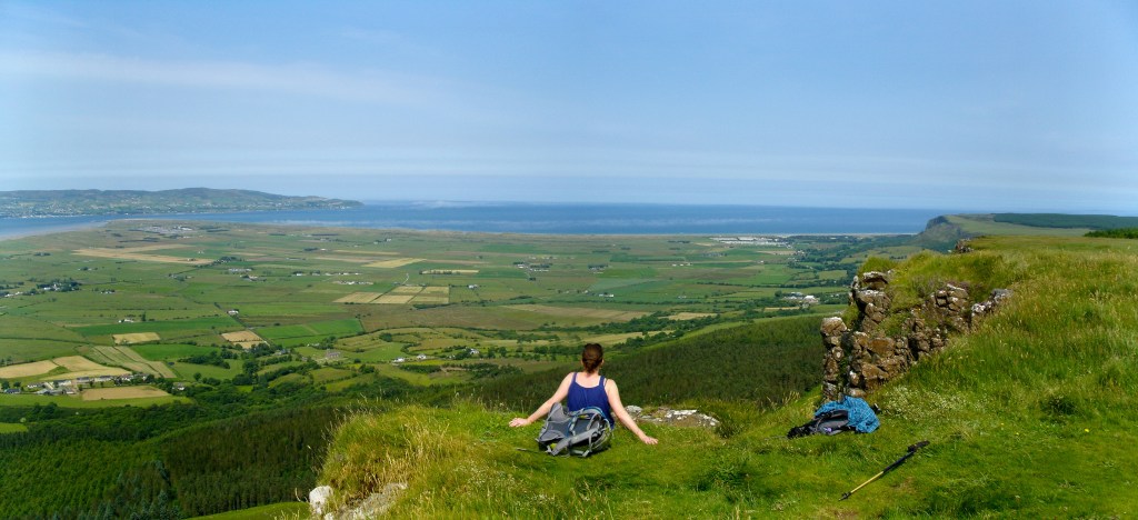
The plain at Lough Foyle was ideal for the baseline; it was relatively flat and surrounded by mountains on which the Principal Triangulation stations were located. As noted by John O’Donovan in his draft Memorandum about the area: “there being nowhere else on the island so large a portion of level alluvial lands so compactly circumstanced as the lowlands of Magilligan and the coterminous plain of Myroe (Moyroe) in the parish of Tamlaght Finlagan.” [1] But it was intersected by many hedges, walls and other obstacles, including the River Roe, all of which would have to be crossed, and the land was under cultivation, too. The precise alignment of the line would depend on a detailed survey, which the officers and sappers began in May 1825 and finished by the end of January 1826. [2]
Before the Survey of Ireland, baselines had been measured by various methods, such as fixed-length rods made of glass or wood or a version of Gunter’s 100-foot chain, made with 66 iron links. All proved unsatisfactory as the length of the rods changed with temperature, or they flexed between the trestles supporting their ends, and metal chains were affected by wear between the chain links. The effect of temperature was of greatest concern: later experiments would show that a change of 1° Fahrenheit would alter the length of a 10-foot iron bar by 0.00783 inches, a significant 1 foot over eight miles for every 4° change. [3]
The French had devised a method using platinum and copper rods, allowing the relative expansion of the two metals to be corrected. Their rods had been used to measure baselines for a triangulation commissioned by the Paris Academy of Sciences to determine the length of the metre, defined as one ten-millionth of the length of the meridian passing through Paris between the North Pole and the Equator. Jean Baptiste Delambre, Director of the Paris Observatory, and Pierre Mechain, a surveyor who had worked on the French side of the Paris–Greenwich triangulation, measured their arc by triangulation, from 1792 to 1799, between Paris and Barcelona with two baselines, one in the north of France, the other in the south. Although the revolution in France delayed their results and then the war with England, and it was affected by an error in the assumed size and shape of the Earth, their work led to the abandonment of chains for measuring baselines and a return to the idea that rods were the best method. [4]
Colby consulted widely on the matter, including with his friend Charles Babbage, the mathematician, philosopher, and inventor of the first mechanical computer. Then, with “ardent zeal and craving for improvement,” during the winter of 1824-25, he tasked his officers with finding a solution to a system for measuring his Irish baseline. [5]
It was Colby himself who came up with the answer.
“To Colby the design, to Drummond the execution”
“Come my boy, I have something to talk to you about”. Colby rarely walked and, grabbing Portlock’s arm, he practically ran him to his apartments in the Tower, where the offices of the Survey were based. There over dinner, he outlined his idea for self-compensating measuring bars for measuring a baseline near Lough Foyle. The distance was an essential element of the Trigonometrical Survey and would be something that the maps of Ireland would rely on for the next 169 years. [6]
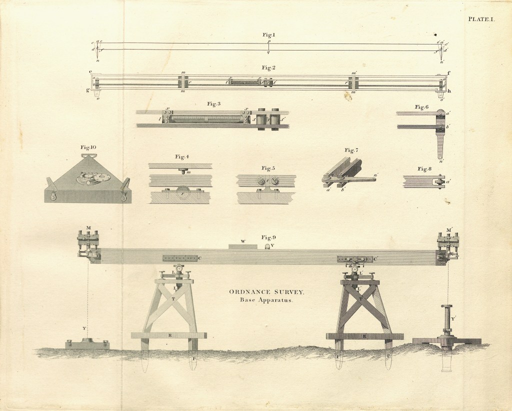
Colby’s principle was based on the French bars and the compensating mechanisms of clocks and their pendulums. He used two bars of different materials – one of brass and the other of iron, kept apart to avoid the effects of friction. They were fixed at the centre, allowing the ends to expand and contract freely. His innovation was at the ends of the bars, which were connected by a tongue or a lever that would move as the bars expanded or contracted by different amounts, rotating around a “compensation point” in such a way as to keep a constant distance from a similar compensating point on a lever at the other end of the bars.
Colby gave the job of perfecting his idea to one of his brightest officers, Lieutenant Thomas Drummond, with whom he had worked on the Scottish mountains. Drummond commissioned Edward Troughton, the Cumberland-born instrument maker, to construct and test the bars. Troughton was known for manufacturing a range of astronomical surveying and navigation instruments, including the Troughton Equatorial Telescope in 1795. This 2-inch aperture refractor telescope can still be found at Armagh Observatory today. He went on to establish Troughton & Simms Ltd, the famous manufacturer of survey, navigation, and scientific instruments, which remained in business until it finally closed in 1966.
Six pairs of bars were made, each measuring 10 feet 1½ inches long, ½ inch broad, and 1½ inches deep, weighing 136 lbs. The bars were placed 1¼ inches apart on rollers inside a wooden box constructed to protect them. Drummond then determined the compensation points and lengths of the two bars against two standard bars, also made by Troughton. The idea was Colby’s, the execution was Drummond’s. [7]
The baseline measurement had been significantly delayed as Troughton perfected the manufacture of the compensating bars and Drummond completed his tests. Colby was not going to hurry precision! It wasn’t until the 24th of June 1827 that preliminary work on the site by Lough Foyle began when a base camp consisting of 27 Artillerymen, 25 Sappers, and three civilian labourers was established “…. by the side of Mr Gage’s park wall, near the Roe”. [8]
Next Week: The measurement of the baseline.
[1] “Ordnance Survey Memoirs of Ireland. Parish of Co. Londonderry III 131-5 Vol.11.” Edited by Angelique Day and Patrick McWilliams. The Institute of Irish Studies The Queen’s University of Belfast. 1991. From the section of the Memoir by John O’Donovan and George Petrie [1835] p98
[2] Ordnance Survey Progress Reports and Returns, return by Captain M.A.Waters RE, January 1826; NAI, OS/1/1.
[3] “An Account of the Measurement of Lough Foyle Base with its verification and extension by Triangulation”, by Captain William Yolland, Board of Ordnance, 1847.
[4] “The Measure of All Things: The Seven-Year Odyssey and Hidden Error That Transformed the World”, Ken Alder, Free Press, 2003.
[5] “Memoir of the life of Major General Colby”, Lt. Col. J.E. Portlock; Shelley, Jackson & Halliday, 1869, page 267.
[6] Based on the story told by Portlock in his book “Memoir of the life of Major-General Colby”, Seeley Jackson & Halliday, 1869.
[7] “To Colby the design, to Drummond the execution” is a quote attributed to Larcom in “Thomas Drummond – Life and Letters” by R Barry O’Brien, p 57, and noted by John Andrews in his book “A Paper Landscape”, Oxford University Press, 1975.
[8] Letter from Drummond’s papers quoted by Close, page 115.
By subscribing, you will be notified of new posts.
