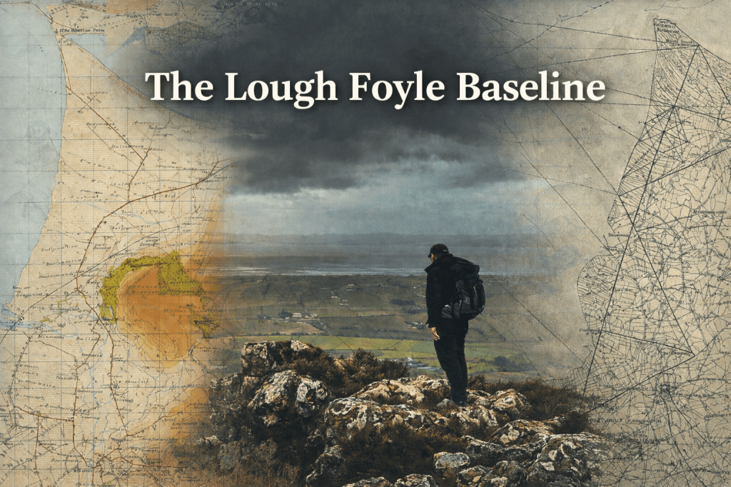
It started with a measured line on the ground, “on which the credit of the whole survey would greatly depend”.
Before Satellites
“Every Prince should have a Draught of his Country and Dominions …
— Thomas Burnet, The Theory of the Earth (1684)
Each country measures its own territory, sets its borders and asserts its sovereignty, often using maps to make its authority visible. They did so within their own national reference systems. When satellites were launched, a new global reference system was established.
When I arrived in Ireland in 1994, the Global Positioning System was beginning to transform navigation and surveying. It was not yet the indispensable everyday tool it has since become, but its potential was unmistakable. My first task was to reposition Ireland within this new global system, linking the existing national system, rooted in Colby’s work, to a modern, three-dimensional framework. I will come back to cover this project in a later blog post.
For now, my curiosity was aroused. How had the original system been created?
Before satellites fixed position, before radio signals carried coordinates, before orbital clocks synchronised time, there was a measured line on the ground. Colby’s Lough Foyle base was that line. Everything that followed, the triangulation, the mapping, administration, and even sovereignty, depended upon it.
How was it made? Why there? And why did it matter?
I begin the story by visiting the site of the baseline, on the shores of Lough Foyle.
Lough Foyle
The views from the top of the cliffs of Binevenagh Mountain are expansive. To the west, across Lough Foyle, lie the hills of Donegal, and to the north, across the sea, the western Isles of Scotland. The rocky escarpment Binevenagh rises 1,000 feet above a plain that stretches eight miles between Magilligan Point and Ballykelly, just 18 feet above sea level, intersected by hedges and walls surrounding green fields. Between the mountain and the sea, it is a landscape of great contrast and great beauty.
The wide, flat, sandy expanses of Benone Beach to the north and Magilligan Strand to the west are edged by sand dunes that hide a prison, an army base and holiday caravan sites. A Martello Tower at Magilligan Point, built to protect the wide natural harbour of the Foyle estuary from Napoleonic invasion, mirrors a fort across the entrance of a Lough full of native oysters and the once abundant wild Atlantic salmon swimming to their spawning grounds. Cut in half by the River Roe, the plain is now also intersected by a railway considered the most scenic in Ireland.
Silently, below the cliffs of Binevenagh Mountain, stand three monuments aligned precisely to within millimetres of each other. They form the Lough Foyle Baseline, the heart of Colby’s plan to map Ireland. It was a physical and intellectual endeavour of monumental proportions, creating the most detailed map of a country ever produced on which the valuation of the country was based. It made a geological survey, an archaeological survey and a picture of the landscape of pre-famine Ireland, documenting many of its placenames. Although it was Colby’s outstanding achievement, it would also be the basis for two noteworthy political and administrative careers. It made the reputation of a respected Irish language scholar and was responsible for three scientific innovations of practical and broader importance.
Witnessed by eminent scientists and surveyors, the techniques pioneered in Ireland would be replicated across the British Empire, including by Sir George Everest on his Survey of India and the Astronomer at Cape Town. The distance measured between the monuments on Lough Foyle was so precise that when remeasured by microwaves in 1960, it was found to be within one inch of Colby’s measurement. [1]
The monuments have stood for two hundred years, the foundation of all distances in Ireland and Britain, until satellites changed our understanding of the world.
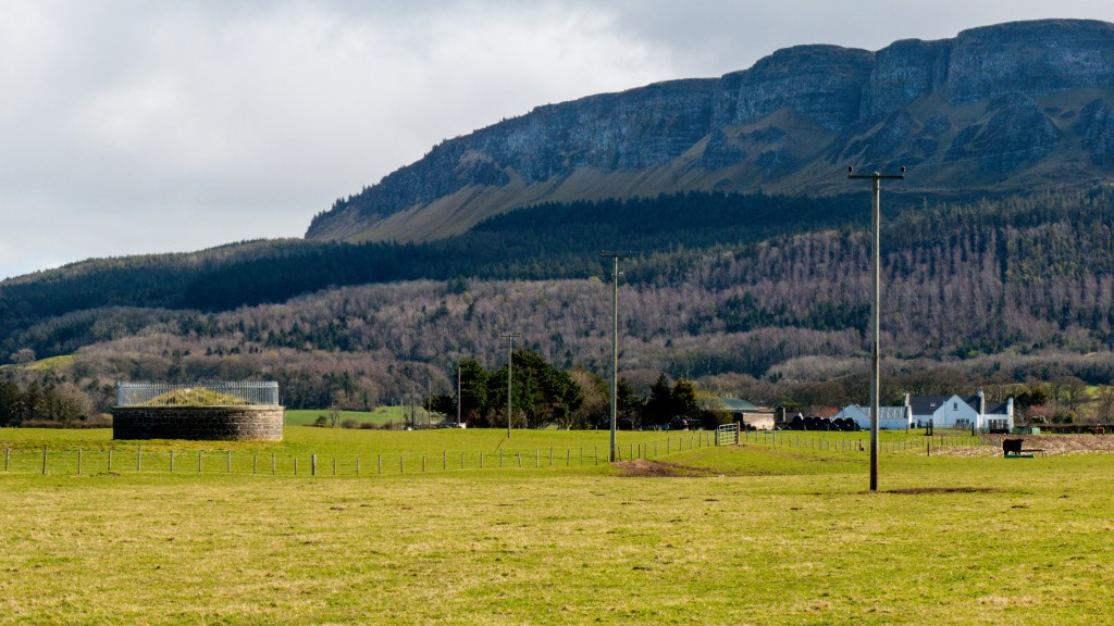
Minearny Base Tower under Binevenagh Cliffs
*****
The Great Triangulation
“….. it is requisite to commence with the Great Triangulation on which subsequent operations for the local survey are founded”.
–Thomas Colby [2]
Colby’s first task in Ireland was to extend the Trigonometrical Survey from Britain to provide the framework for the map. It would require greater accuracy and “much greater dispatch to the work than has occurred in the Trigonometrical Survey of England”. [3]
The accurate measurement of position and distance across large areas still relied on triangulation, the method Frisius had conceptualised 300 years earlier. Although the instruments had been significantly improved, the technique had remained largely the same since Snell refined it. The surveyor’s job was to measure two initial points on the earth’s surface – a baseline – as accurately as possible, from which angles were measured using a theodolite so that all the distances across a network of triangles could be calculated using trigonometry; hence, the “trigonometric” survey.
The points of the triangles had to be inter-visible. Therefore, they were typically located on the tops of hills and mountains so that a whole country could be covered with the largest triangles possible in a primary or principal triangulation. These triangles could then be broken down into smaller secondary and tertiary triangles, from which the maps could be surveyed.
In 1824, accompanied by Lieutenant Thomas Drummond, Colby travelled Ireland from north to south, selecting the most suitable mountains for the principal points of his triangulation and the location for a new baseline “on which the credit of the whole survey would greatly depend”.
He “… made a cursory examination of the general idea of the country and to seek a proper place for the measurement of a new Baseline. The shores of Lough Foyle presented most advantageous for this purpose.” [4]
*****
[1] “An outline of the re-triangulation of Northern Ireland”, Chapter III – “The re-measurement of the Loch Foyle Base Line”, Lt. Colonel W.R. Taylor, HM Stationery Office, 1967.
[2] Lt. Colonel Colby, first “Report to Sir Henry Hardinge KCB on the Present State and Progress of the Irish Survey” NAI, OS/1/1. Sir Henry Hardinge was the Clerk of the Ordnance, who handled Accounts and correspondence for the Master General of the Board of Ordnance. He had served in the Peninsular War and Waterloo under Wellington.
[3] Report of the Select Committee of the House of Commons into a Survey and Valuation of Ireland, Chaired by Mr. Spring-Rice, 1824.
[4] “Report to Sir Henry Hardinge KCB on the Present State and Progress of the Irish Survey, Lt Col Thomas Colby, 2 February 1826”, NA OS/1/1.
By subscribing, you will be notified of new posts.
