The Duke of Wellington’s influence on the origin of the Ordnance Survey of Ireland.
If the Isles of Scilly exposed the cost of being in the wrong place, and the Paris–Greenwich triangulation proved that position could be measured, Ireland posed a different challenge. By the early 1820s, the question was no longer whether the country should be surveyed, but how, by whom, and for what purpose. Concerns that had begun with navigation, security, and scientific accuracy now converged on the ambitious goal of a single, uniform, and authoritative map of the entire island. This was not simply a technical project, but an act of state formation, in which measurement, taxation, land reform, and political control became inseparable. Thus, a demand for “a complete map” of Ireland emerged where Enlightenment science, post-Napoleonic security, and the administrative imperatives of Union met. It would shape the State’s understanding of its landscape and its governance for generations.
The Duke of Wellington, as Master General of the Board of Ordnance, was material to the decision to begin the survey work in Ireland and for the Board of Ordnance to do it. He was himself Irish-born, with a family (the Wellesleys) tracing their Irish roots back six centuries to Henry II’s Standard Bearer, who had accompanied the King on an invasion of Ireland, settling in Ireland with descendants buying property and intermarrying with others of the Anglo-Norman families in what became known as the Protestant Ascendancy. Wellington himself displayed “the curious trait” of “studied indifference to his own history”, [2] summed up by the quote that “being born in a stable does not make a man a horse” when referring to his birthplace. However, they are not certainly his words. He considered himself British, not Irish, along with many others. His monument at the southern end of Phoenix Park stands as testimony to his achievements in war and politics, and at the other end lies the Ordnance Survey Office, a distant reminder of his influence in the decision to extend the Trigonometrical Survey to Ireland.
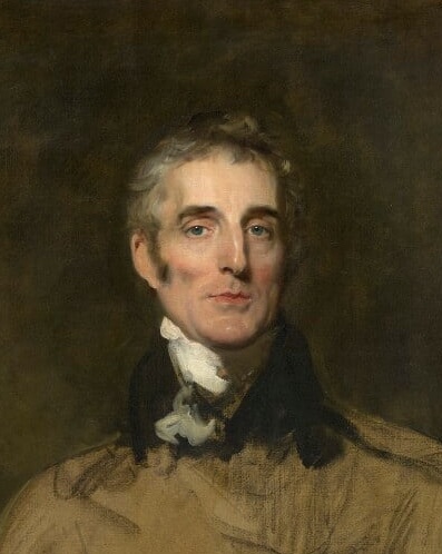
by Sir Thomas Lawrence
oil on canvas, 1829
NPG 7032
© National Portrait Gallery, London
Wellington had been appointed Master General of the Board of Ordnance in 1818 following his return from Europe after a very successful military career, culminating in the defeat of Napoleon at Waterloo. A national hero, the Iron Duke’s authority in this matter was significant. A military man not given to petty bureaucratic interference, his battle and field experience recognised the value of a map and the difficulties of operating without one (in any sense, militarily or civilian). As a military strategist, he understood the threat of invasion from Ireland, a back door to England’s security, exploited unsuccessfully by the French during the Napoleonic Wars. To him, the value of a good map was not in any doubt, and as a man who had control of all he did, retaining this control in matters of the Irish Survey was essential.
Thomas Colby had petitioned Wellington for the job of Superintendent of the Trigonometrical Survey in Great Britain following the retirement of William Mudge and was appointed in 1820. Colby wrote to the Board of Ordnance in February 1824, proposing that the Board undertake a Survey in Ireland required to support land-based tax reform. This was probably at Wellington’s request, following a series of conversations Wellington had with the Chief Secretary of Ireland about increasing unrest there and the need for land reform. [3] In addition, the Admiralty had called for the Board of Ordnance to provide the trigonometrical framework for a new hydrographic survey following the Napoleonic wars, repeating their request in 1819 during a Parliamentary debate and again in 1822 after one of their ships had been wrecked on uncharted sandbanks. [4]
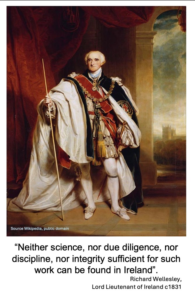
The Board of Ordnance’s involvement was strongly supported by the Lord Lieutenant of Ireland, the 1st Marquess Wellesley, elder brother of the Duke of Wellington. In giving his support, the Lord Lieutenant stated unequivocally that the Irish Engineers or surveyors could not carry out the proposed survey as they did not have the “science, skill, diligence, discipline nor integrity”, adding that they had contributed to the “enormous and dangerous errors” exhibited on official charts and maps of the Irish coast.[5]
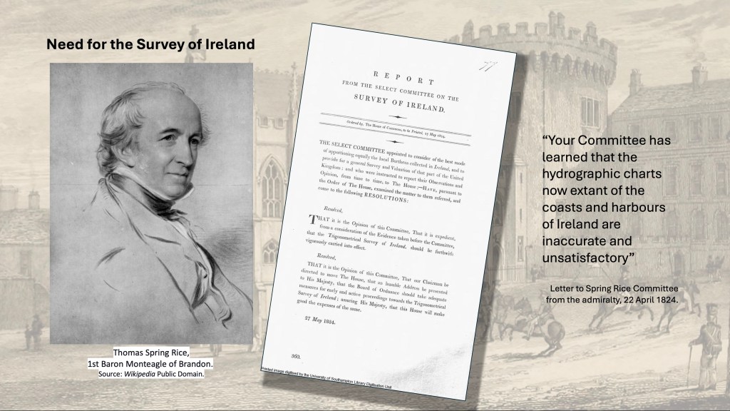
Wellington moved quickly. Within a week of receiving Colby’s letter, twenty cadets were being trained for deployment to Ireland. Such speed alarmed some Irish Members of Parliament. The Board of Ordnance, whilst eminently qualified to do the trigonometric work, would take too long and produce a map unsuited to Ireland’s civilian needs. So, the UK Parliament established a committee to examine Ireland’s particular needs, chaired by Thomas Spring-Rice. Its role was to “consider the best mode of apportioning more equally the local burthens collected in Ireland, and to provide for a general survey and valuation”. [1] It concluded its work in four very rapid months. [6]
One of the members of the Committee was Richard Wellesley, Member of Parliament for Ennis, who happened to be the illegitimate son of the Lord Lieutenant by his mistress (and later wife) Hyacinth-Gabrielle Roland. [7] He was an unfortunate character, always attempting to prove himself to his father, who mostly ignored him. One is left to wonder if he agreed to be the Lord Lieutenant’s “eyes and ears” on the Committee in an attempt at ingratiating himself with his father.
Colby arrived before the Committee thoroughly prepared. On his first day of evidence, he presented a sample map of part of Kent, surveyed at six inches to the mile, and argued that this scale was best suited to Ireland. By his second appearance, it was, at least as far as he was concerned, the agreed scale. [8] The Committee nonetheless examined continental precedents, noting a French map at 1:2,500 scale and one from Bavaria at 1:5,000 scale, the latter of which was judged sufficient for the purchase and sale of real estate. In Ireland, however, valuation was to be based on townlands, the “ancient and recognised divisions of the country”, rather than individual field boundaries, which would have been costly and slow to survey. On that basis, and supported by Colby’s already-prepared calculations of sheet numbers and costs, the Committee concluded that “The best scale for effecting the intended survey, appears to your committee that of six-inches to the English mile.”
Wellington agreed to do the work on condition that he be “allowed to perform the service in my own way” or that he would not do it at all. The Lord Lieutenant of Ireland supported the Board of Ordnance, the Master General of the Board of Ordnance agreed to do it, and the head of the Trigonometrical Survey was well briefed and capable of undertaking the work. The new work was to “… supersede all local topographic proceedings… However credible”, having been “laid down upon a variety of scales with imperfect instruments, and without pretension to scientific accuracy”.
It is difficult to see how else the Committee could decide, and they concluded: “It has given your Committee great satisfaction to think that the direction of the survey can be undertaken by the Board of Ordnance; they cannot conceive any other authority so well calculated to ensure the scientific accuracy and unity of principle which ought to distinguish a great national work”. A sense of a foregone conclusion is further suggested by the issue of minutes by the Board of Ordnance on the 22nd of June 1824, the day after the Committee’s report was signed, ordering Colby to take the necessary steps to proceed with the survey.
The Committee’s report was neither debated by Parliament nor endorsed by the Treasury. Parliament had already approved some funding, and further funds were made available via the Board of Ordnance estimates the following year (1825) for the exact amounts Colby had given to the Committee previously. Reporting directly to Wellington, Colby would do as commanded and provide the control that Wellington demanded. [9]
Colby wasted no time, immediately visiting Ireland to conduct a reconnaissance. [10]
Footnotes
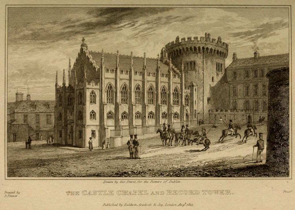
Header Image: Dublin Castle Chapel and Record Tower, 1821 — steel engraving after a drawing by George Petrie, presenting the early 19th-century architectural profile of the Chapel Royal alongside the medieval Record Tower in Dublin Castle’s historic complex. Source Library of Congress
[1] The Spring Rice Report, House of Commons 1824 (445) viii 79.
[2] “Wellington The Years of the Sword” Elizabeth Longford, The Literary Guild, 1969.
[3] Henry Goulburn.
[4] “A History of the Ordnance Survey”, Edited by W.A. Seymour, Dawson,1980. Chapter 7 The Survey of Ireland to 1847, p 79-80.
[5] Letter Lord Wellesley to Field Marshall the Duke of Wellington, Dublin 17 Feb, 1824. From “The Origins of Ireland’s Ordnance Survey”, Finnian O’Cionnaith, Four Courts Press, 2024. Appendix B, p174.
[6] “The Origin of Ireland’s Ordnance Survey”, Finnion O’Cionnaith,Four Courts Press, 2024.
[7] Richard Wellesley is listed as a member in the minutes of the Committee, but didn’t seem to add much to the proceedings. He could be confused with his father, also Richard Wellesley. However, it would have been highly unusual for the Lord Lieutenant, who is the King’s representative in Ireland, to participate in a Committee otherwise made up of MPs from the House of Commons. The ‘Wellesley’ in question is more likely the MP.
[8] Thomas Colby evidence to the Spring-Rice Committee, 2 April 1824, quoted in “The Origins of Ireland’s Ordnance Survey”, Finnian O’Cionnaith, Four Courts Press, 2024.
[9] “A Paper Landscape”, J.H. Andrews, Oxford University Press, 1975, p27.
[10] Lieutenant Colby’s First Report to Sir Henry Hardinge, KCB, on the present state and progress of the Irish Survey, 2 February 1826, NAI, OS/1/1.
By subscribing, you will be notified of new posts.

Response
[…] différence“, showed how position could be fixed by precise measurement; and finally, “A Complete Map“, where science, administration and politics combined to produce a systematic survey of the […]
LikeLike